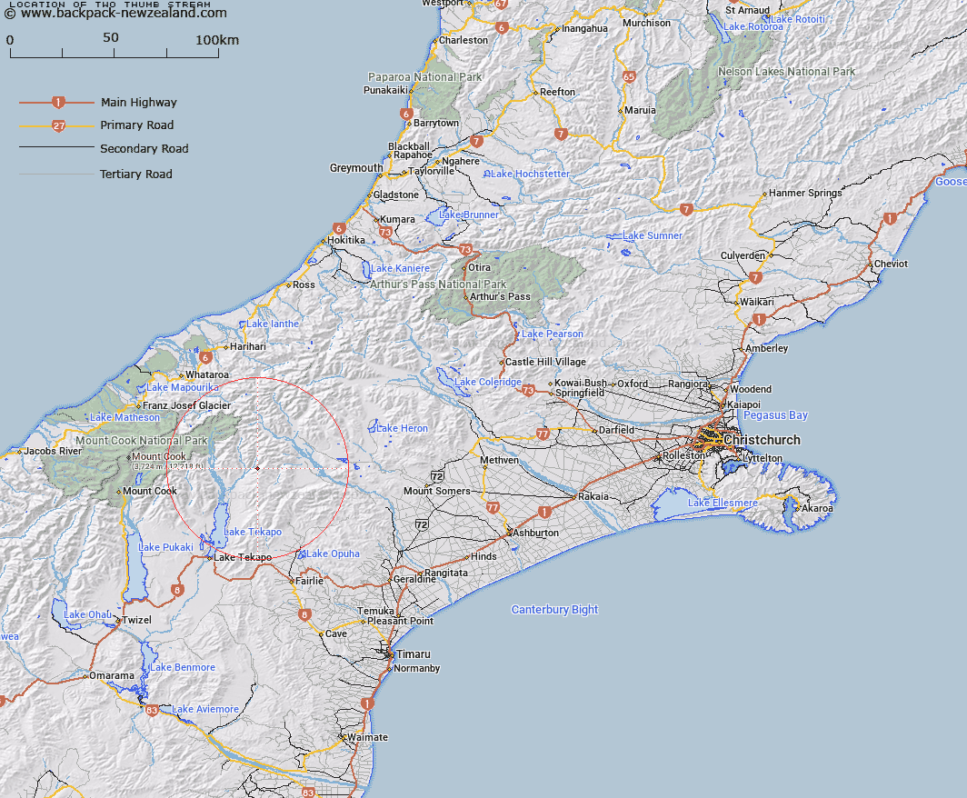
Map showing location of Two Thumb Stream


LINZ description: Left bank tributary of North East Gorge Stream, rising South-east of Split Peaks in the Two Thumb Range, flowing South-westward and joining North East Gorge Stream 1.25km South-east of Trig. B (Geodetic Code ANAR). Block XVI Godley Survey District.
Latitude: -43.637501
Longitude: 170.686371
Northing: 5165786.9
Easting: 1413378.7
Land District: Canterbury
Feat Type: Stream


Scroll down to see a more detailed road map and below that a topographical map showing the location of Two Thumb Stream. The road map has been supplied by openstreetmap and the topographical map of Two Thumb Stream has been supplied by Land Information New Zealand (LINZ).

Yes you can use the top static map for you school/university project or personal website with a link back. Contact me for any commercial use.

Two Thumb Stream Map New Zealand


New Zealand places in our database
[ A ] [ B ] [ C ] [ D ] [ E ] [ F ] [ G ] [ H ] [ I ] [ J ] [ K ] [ L ] [ M ] [ N ] [ O ] [ P ] [ Q ] [ R ] [ S ] [ T ] [ U ] [ V ] [ W ] [ X ] [ Y ] [ Z ]


Closest 20 Streams to Two Thumb Stream

North East Gorge Stream ( 1.57km )   Third Waterfall Stream ( 4.69km )   Second Waterfall Stream ( 4.96km )   Ajax Stream ( 5.78km )   First Waterfall Stream ( 6.29km )   Chevalier Stream ( 6.81km )   Stony Stream ( 7.2km )   Trojan Stream ( 7.32km )   Pack Horse Stream ( 7.63km )   Blind Spur Stream ( 7.81km )   Sweeps Stream ( 7.84km )   Stone Hut Stream ( 9.09km )   Bush Stream ( 9.49km )   Lower Tindill Stream ( 9.7km )   Toms Stream ( 9.96km )   Station Stream ( 10.52km )   Alma Stream ( 10.68km )   Black Birch Creek ( 10.98km )   Sawtooth ( 12.03km )   Ribbonwood Stream ( 12.31km )   Upper Tindill Stream ( 12.84km )   Weka Stream ( 13.2km )   Ninety Five Stream ( 13.37km )   Camp Creek ( 13.38km )   The Growler ( 13.78km )   Godley River North Branch ( 13.79km )   Scour Stream ( 14.28km )   Brabazon Stream ( 14.37km )   Camp Stream ( 14.49km )   Neutral Creek ( 14.58km )   Moonlight Stream ( 14.88km )   Mount Gerald Stream ( 15.28km )   Carneys Creek ( 15.43km )   Macaulay River ( 15.56km )   McKinnon Stream ( 16.98km )   Lucifer Stream ( 17.21km )   Pikes Peak Stream ( 17.58km )   Pollock Stream ( 18.26km )   Cloudy Stream ( 18.33km )   Ribbonwood Creek ( 18.46km )