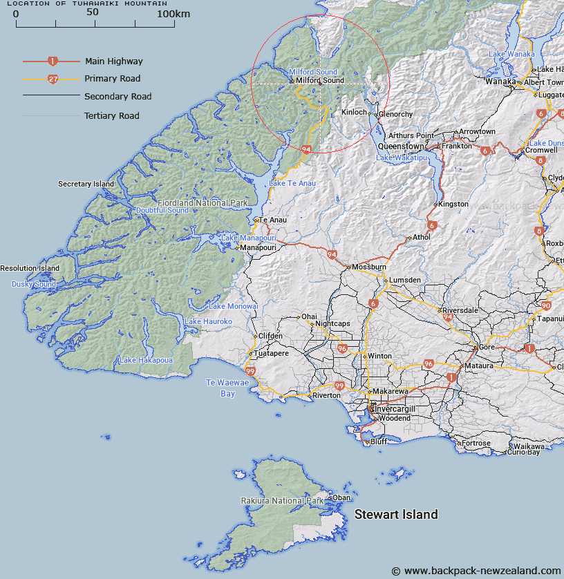
Map showing location of Tuhawaiki Mountain


LINZ description: East of Taiaroa Peak, Central Darran Mountains
Latitude: -44.684428
Longitude: 168.076208
Northing: 5040300
Easting: 1209800
Land District: Southland
Feat Type: Hill


Scroll down to see a more detailed road map and below that a topographical map showing the location of Tuhawaiki Mountain. The road map has been supplied by openstreetmap and the topographical map of Tuhawaiki Mountain has been supplied by Land Information New Zealand (LINZ).

Yes you can use the top static map for you school/university project or personal website with a link back. Contact me for any commercial use.

Tuhawaiki Mountain Map New Zealand


New Zealand places in our database
[ A ] [ B ] [ C ] [ D ] [ E ] [ F ] [ G ] [ H ] [ I ] [ J ] [ K ] [ L ] [ M ] [ N ] [ O ] [ P ] [ Q ] [ R ] [ S ] [ T ] [ U ] [ V ] [ W ] [ X ] [ Y ] [ Z ]


Closest 20 Hills to Tuhawaiki Mountain

Taiaroa Peak ( 1.21km )   Mount Revelation ( 2.2km )   Karetai Peak ( 2.75km )   Te Wera Peak ( 3.38km )   Apirana Peak ( 3.69km )   East Peak ( 4.48km )   Patuki Mountain ( 4.6km )   Mount Gifford ( 4.6km )   High Peak ( 4.77km )   Third Peak ( 5.06km )   Mihj Peak ( 5.18km )   Low Peak ( 5.53km )   Mount Underwood ( 5.87km )   The Twins ( 5.92km )   The Sentinel ( 6.05km )   Waitiri ( 6.23km )   Mount Mahere ( 6.98km )   Adelaide Peak ( 6.99km )   Mount Tarewai ( 7.03km )   Mount Milne ( 7.17km )   Sabre Peak ( 7.23km )   Mount Syme ( 7.28km )   Barrier Knob ( 7.4km )   Marian Peak ( 7.51km )   Mount Gunn ( 7.86km )   Barrier Peak ( 7.9km )   Mount Madeline ( 8.17km )   Conical Hill ( 8.41km )   Harris Saddle ( 8.93km )   Harris Saddle/Tarahaka Whakatipu ( 8.93km )   Mount Erebus ( 9.29km )   East Peak ( 9.46km )   Mount Xenicus ( 9.53km )   Second Peak ( 9.58km )   Middle Peak ( 9.63km )   Mount Lippe ( 9.65km )   Mount Talbot ( 9.65km )   West Peak ( 9.96km )   Mount Lyttle ( 10.23km )   Billy the B ( 10.23km )