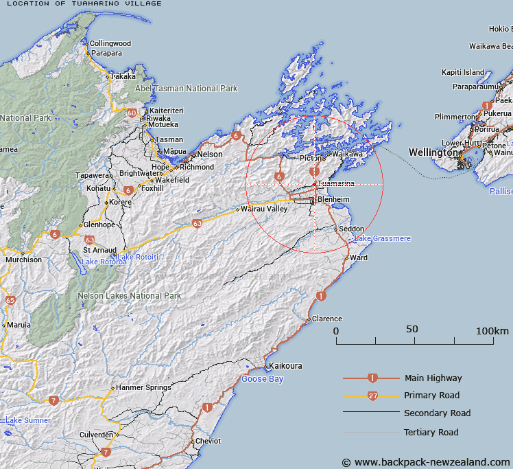
Map showing location of Tuamarino Village
LINZ description: Locality on the left bank of the Wairau River, 9km North of Blenheim and 16km South of Picton. Cloudy Bay Survey District.
Latitude: -41.427013
Longitude: 173.95805
Northing: 5413395.8
Easting: 1680051.7
Land District: Marlborough
Feat Type: Locality
Latitude: -41.427013
Longitude: 173.95805
Northing: 5413395.8
Easting: 1680051.7
Land District: Marlborough
Feat Type: Locality

Scroll down to see a more detailed road map and below that a topographical map showing the location of Tuamarino Village. The road map has been supplied by openstreetmap and the topographical map of Tuamarino Village has been supplied by Land Information New Zealand (LINZ).
Yes you can use the top static map for you school/university project or personal website with a link back. Contact me for any commercial use.
[ A ] [ B ] [ C ] [ D ] [ E ] [ F ] [ G ] [ H ] [ I ] [ J ] [ K ] [ L ] [ M ] [ N ] [ O ] [ P ] [ Q ] [ R ] [ S ] [ T ] [ U ] [ V ] [ W ] [ X ] [ Y ] [ Z ]