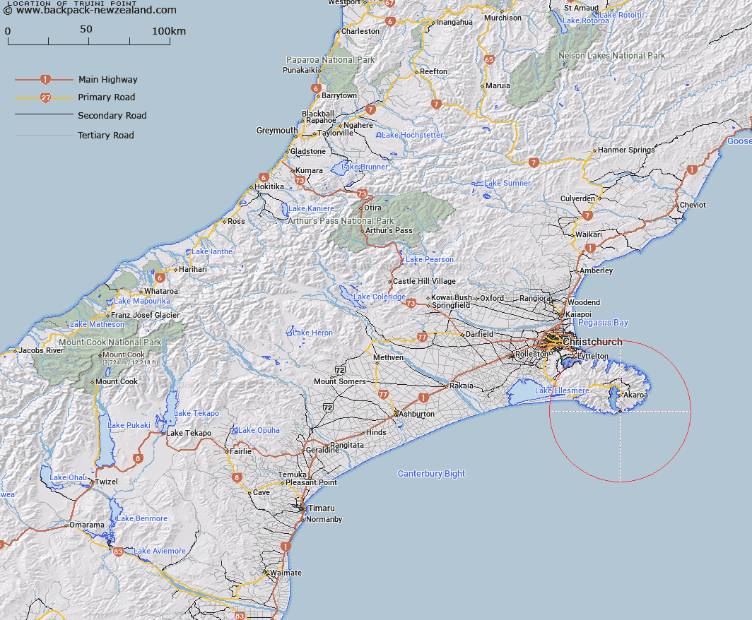
Map showing location of Truini Point


LINZ description: The eastern headland of Akaroa Harbour. Feature shown on Infomap 346-02 Te Wai Pounamu Edition 1 1995
Latitude: -43.887856
Longitude: 172.968926
Northing: 5140582.1
Easting: 1597504
Land District: Canterbury
Feat Type: Point


Scroll down to see a more detailed road map and below that a topographical map showing the location of Truini Point. The road map has been supplied by openstreetmap and the topographical map of Truini Point has been supplied by Land Information New Zealand (LINZ).

Yes you can use the top static map for you school/university project or personal website with a link back. Contact me for any commercial use.

Truini Point Map New Zealand


New Zealand places in our database
[ A ] [ B ] [ C ] [ D ] [ E ] [ F ] [ G ] [ H ] [ I ] [ J ] [ K ] [ L ] [ M ] [ N ] [ O ] [ P ] [ Q ] [ R ] [ S ] [ T ] [ U ] [ V ] [ W ] [ X ] [ Y ] [ Z ]


Closest 20 Points to Truini Point

Akaroa Head ( 0.87km )   Gateway Point ( 1.21km )   Timutimu Head ( 1.91km )   Dyke Head ( 3.86km )   Redcliffe Point ( 5.72km )   Te Ahiteraiti ( 5.83km )   Short Reef Point ( 6.91km )   Cape Three Points ( 7.98km )   Long Reef Point ( 8.06km )   Green Point ( 8.19km )   Otutereinga ( 9.48km )   Opukutahi ( 9.6km )   Clay Point ( 11.34km )   Snuffle Nose ( 11.38km )   Goat Point ( 12.24km )   Hammond Point ( 12.7km )   South Head ( 13.57km )   North Head ( 15.16km )   Pout?koro Head ( 17.77km )   Putakolo Head ( 17.77km )   East Head ( 18.91km )   Steep Head ( 20.93km )   Katawa Head ( 21.51km )   Spyglass Point ( 23.68km )   East Head ( 24.76km )   West Head ( 25.01km )   Teopopaka Point ( 25.07km )   Long Lookout Point ( 26.89km )   Otohuao Head ( 28.31km )   Wakaroa Point ( 29.49km )   Pigeon Point ( 29.67km )   Pukeiti Point ( 30.02km )   Baleine Point ( 32.92km )   Adderley Head ( 33.55km )   Stoddart Point ( 34.88km )   Pauaohinekotau Head ( 35.51km )   Awaroa/Godley Head ( 35.82km )   Godley Head ( 35.82km )   Moepuku Point ( 36.04km )   Sticking Point ( 36.4km )