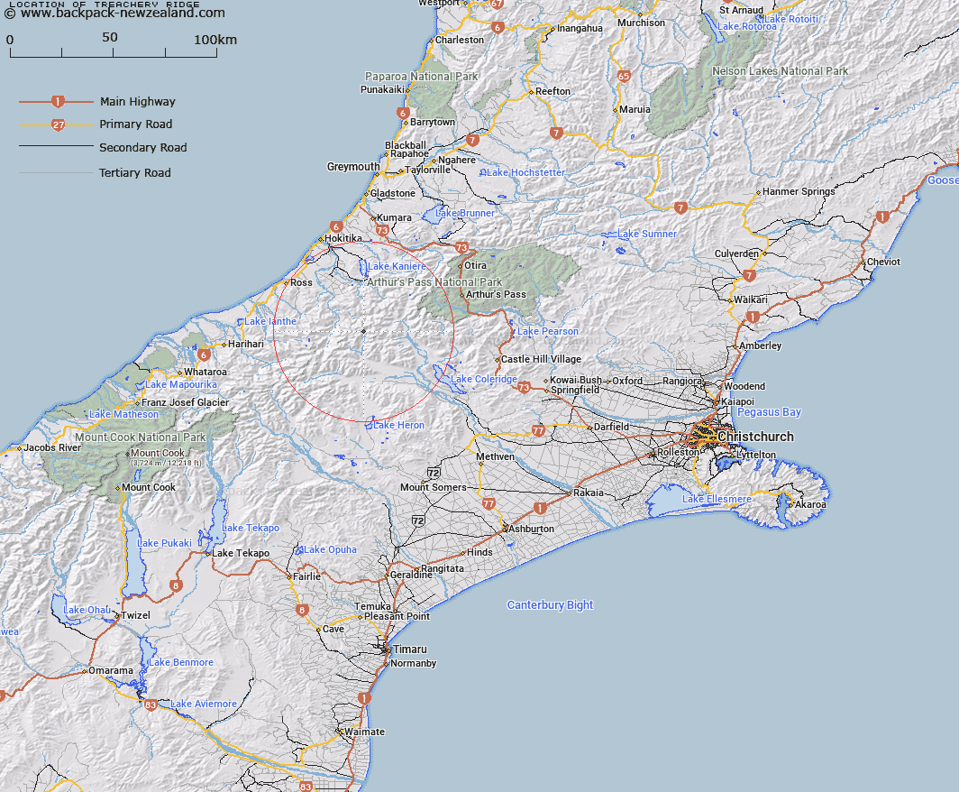
Map showing location of Treachery Ridge


LINZ description: Ridge at the head of the North Mathias River and Canyon Creek on the Southern Alps/Kā Tiritiri o te Moana.
Latitude: -43.094723
Longitude: 171.147056
Northing: 5227000
Easting: 1449200
Land District: Canterbury
Feat Type: Ridge


Scroll down to see a more detailed road map and below that a topographical map showing the location of Treachery Ridge. The road map has been supplied by openstreetmap and the topographical map of Treachery Ridge has been supplied by Land Information New Zealand (LINZ).

Yes you can use the top static map for you school/university project or personal website with a link back. Contact me for any commercial use.

Treachery Ridge Map New Zealand


New Zealand places in our database
[ A ] [ B ] [ C ] [ D ] [ E ] [ F ] [ G ] [ H ] [ I ] [ J ] [ K ] [ L ] [ M ] [ N ] [ O ] [ P ] [ Q ] [ R ] [ S ] [ T ] [ U ] [ V ] [ W ] [ X ] [ Y ] [ Z ]


Closest 20 Ridges to Treachery Ridge

Homeward Ridge ( 4.83km )   Conway Ridge ( 5.3km )   Brunswick Ridge ( 5.69km )   Eliott Ridge ( 10.21km )   Eliot Ridge ( 10.21km )   Commodore Ridge ( 11.09km )   Cropp Brow ( 11.84km )   Long Spur ( 12.45km )   Misty Ridge ( 13.32km )   Yeats Ridge ( 13.39km )   Adventure Ridge ( 13.84km )   Cabot Ridge ( 14.42km )   Knobby Ridge ( 14.52km )   Steadman Brow ( 14.88km )   Max Spur ( 15.24km )   Pahlow Ridge ( 15.32km )   Gerhardt Spur ( 15.51km )   Petrologist Ridge ( 16.28km )   Mikonui Spur ( 17.04km )   Henry Ridge ( 17.31km )   Secretary Ridge ( 17.74km )   Charles Ridge ( 17.83km )   Miserable Ridge ( 17.96km )   Table Spur ( 18.05km )   Galena Ridge ( 18.16km )   Katzenbach Ridge ( 18.18km )   Reeses Ridge ( 18.49km )   Mazda Spur ( 18.53km )   Explorer Ridge ( 18.71km )   Whitehorn Ridge ( 19.15km )   Hamilton Ridge ( 19.3km )   Hinau Spur ( 19.37km )   Golden Spur ( 19.92km )   Sawtooth Ridge ( 20.42km )   Sunshine Spur ( 20.52km )   Marshall Ridge ( 20.8km )   Marshal Ridge ( 20.8km )   Prominent Spur ( 21.66km )   Meharry Spur ( 21.73km )   Donovan Ridge ( 22.62km )