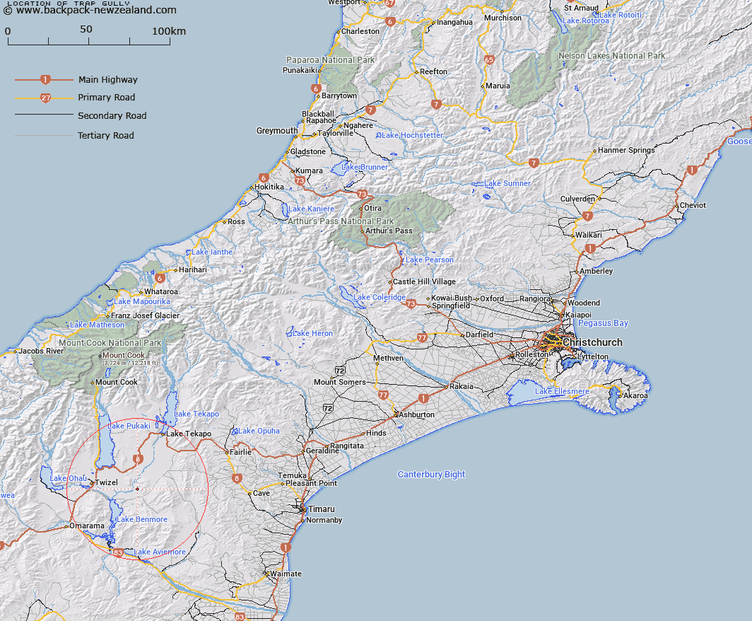
Map showing location of Trap Gully


LINZ description: Gully rises west side of Grays Hills flows south to Big Pass and west to Tekapo River.
Latitude: -44.289182
Longitude: 170.344932
Northing: 5092579
Easting: 1388166.9
Land District: Canterbury
Feat Type: Valley


Scroll down to see a more detailed road map and below that a topographical map showing the location of Trap Gully. The road map has been supplied by openstreetmap and the topographical map of Trap Gully has been supplied by Land Information New Zealand (LINZ).

Yes you can use the top static map for you school/university project or personal website with a link back. Contact me for any commercial use.

Trap Gully Map New Zealand


New Zealand places in our database
[ A ] [ B ] [ C ] [ D ] [ E ] [ F ] [ G ] [ H ] [ I ] [ J ] [ K ] [ L ] [ M ] [ N ] [ O ] [ P ] [ Q ] [ R ] [ S ] [ T ] [ U ] [ V ] [ W ] [ X ] [ Y ] [ Z ]


Closest 20 Valleys to Trap Gully

Brands Gully ( 14.31km )   Cairn Gully ( 17.25km )   Cattle Gully ( 17.53km )   Tomahawk Gully ( 18.58km )   Exhibition Gully ( 21.11km )   Poplar Gully ( 21.23km )   Sunset Gully ( 21.5km )   Cabbage Tree Gully ( 27.17km )   Scrub Gully ( 27.21km )   Boltons Gully ( 30.89km )   Rocky Gully ( 32.69km )   Boundary Gully ( 33.09km )   Rough Gully ( 34.22km )   Briar Gully ( 34.36km )   Disappointment Gully ( 34.59km )   Rocky Gully ( 34.79km )   Big Gully ( 35.6km )   Rocky Gully ( 39.3km )   Plesant Valley ( 40.31km )   Little Cattle Gully ( 44.13km )   Long Gully ( 46.2km )   Horse Gully ( 46.46km )   Manuka Gully ( 48.37km )   Dog Gully ( 49.6km )   Cattle Gully ( 51.79km )   Diggers Gully ( 52.94km )   Golden Gully ( 53.44km )   Fluming Gully ( 53.56km )   Long Gully ( 53.89km )   Rambling Gorge ( 61.82km )   Green Gully ( 63.05km )   Woolshed Gully ( 63.49km )   Third Gully ( 66.37km )   Shelter Hollow ( 66.76km )   Baffle Ravine ( 67.06km )   Also Gully ( 67.28km )   Second Gully ( 67.82km )   Arbor Rift ( 67.93km )   Slip Gully ( 68.2km )   Zora Canyon ( 68.44km )