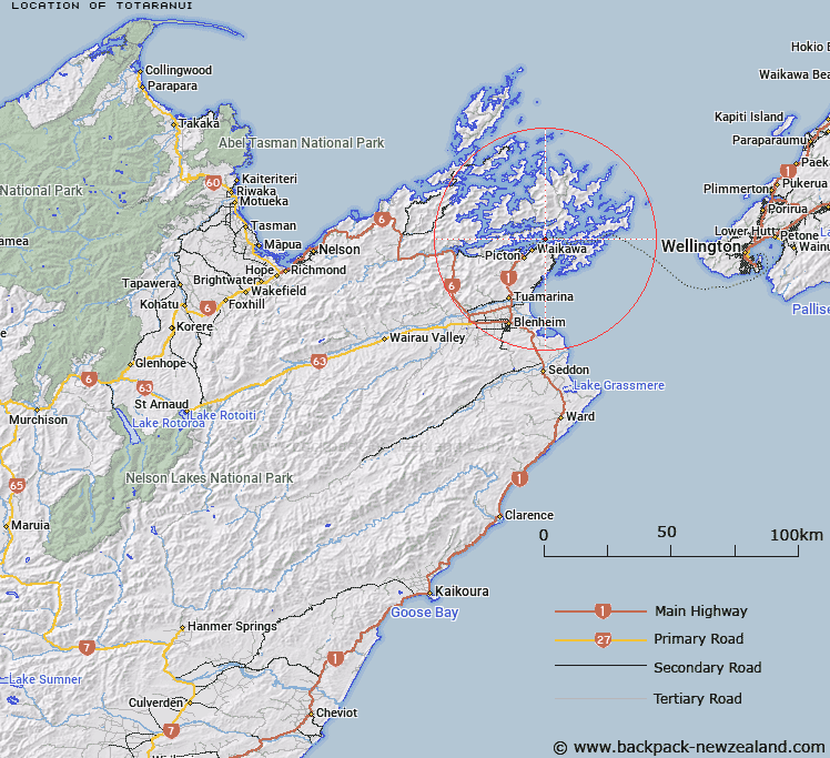
Map showing location of Totaranui


LINZ description: The Māori name for Queen Charlotte Sound. Added to Gaz Anomalies List, QCS not official.
Latitude: -41.233969
Longitude: 174.087059
Northing: 5434700
Easting: 1691100
Land District: Marlborough
Feat Type: Bay


Scroll down to see a more detailed road map and below that a topographical map showing the location of Totaranui. The road map has been supplied by openstreetmap and the topographical map of Totaranui has been supplied by Land Information New Zealand (LINZ).

Yes you can use the top static map for you school/university project or personal website with a link back. Contact me for any commercial use.

Totaranui Map New Zealand


New Zealand places in our database
[ A ] [ B ] [ C ] [ D ] [ E ] [ F ] [ G ] [ H ] [ I ] [ J ] [ K ] [ L ] [ M ] [ N ] [ O ] [ P ] [ Q ] [ R ] [ S ] [ T ] [ U ] [ V ] [ W ] [ X ] [ Y ] [ Z ]


Closest 20 Bays to Totaranui

Queen Charlotte Sound / T?taranui ( 0.65km )   Queen Charlotte Sound (Totaranui) ( 0.65km )   Green Bay ( 1.09km )   Monkey Bay ( 1.28km )   Tauranga Bay ( 1.58km )   Kaipapa Bay ( 1.78km )   Okahu Bay ( 1.81km )   Motueka Bay ( 2.06km )   Kahikatea Bay ( 2.22km )   Blackwood Bay or Tahuahua Bay ( 2.25km )   Macalister Cove ( 2.67km )   Kumutoto Bay ( 2.93km )   Kahika Bay ( 3.3km )   East Bay ( 3.33km )   Whatamango Bay ( 3.56km )   Wairakau Bay ( 3.65km )   Moriori Bay ( 3.66km )   Ahuriri Bay ( 3.68km )   Cherry Bay ( 3.74km )   Ratimera Bay ( 3.87km )   Waikawa Bay ( 3.94km )   Kaipakirikiri Bay ( 4.03km )   Ruakaka Bay ( 4.32km )   Wharetukura Bay ( 4.42km )   Pirapu Bay ( 4.75km )   Maraetai Bay ( 4.88km )   Torea Bay (Torea Moua) ( 4.91km )   Moikarurangi Bay ( 5.03km )   Sandy Bay ( 5.46km )   Titoki Bay ( 5.95km )   Double Cove ( 6.41km )   Portage Bay ( 6.52km )   Fish Bay ( 6.66km )   Hitaua Bay ( 6.67km )   Ohauparuparu Bay ( 6.72km )   Take in Bay ( 6.97km )   East Bay ( 7.12km )   Whangataura Bay ( 7.13km )   Lochmara Bay ( 7.18km )   Puketea Bay ( 7.21km )