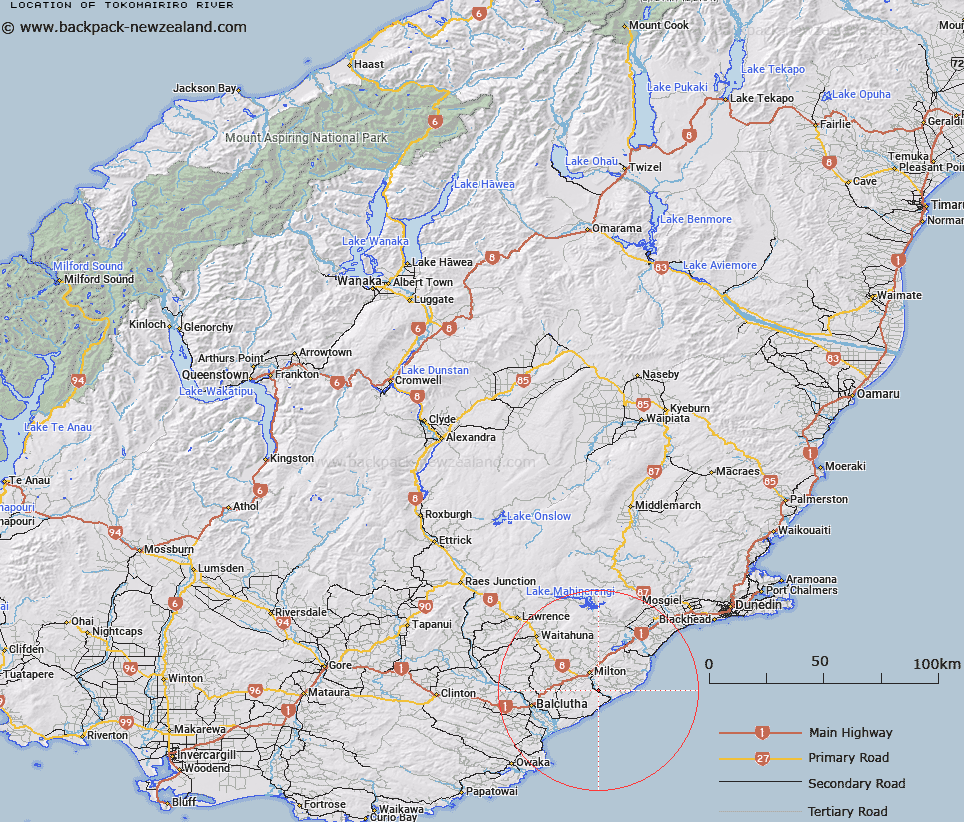
Map showing location of Tokomairiro River


LINZ description: A river flowing generally southeast from the intersection of Tokomairaro River East Branch with Tokomairaro River West Branch just south of Milton to its mouth at the Pacific Ocean. Feature shown on: NZMS260 H45 Edition 1 1981; Infomap 346-02 Te Wai Pounamu Edition 1 1995; NZTopo50-CF15 650871 (source) to NZTopo50-CF16 723774 (mouth)
Latitude: -46.182939
Longitude: 169.995921
Northing: 4881238.9
Easting: 1368159.3
Land District: Otago
Feat Type: Stream


Scroll down to see a more detailed road map and below that a topographical map showing the location of Tokomairiro River. The road map has been supplied by openstreetmap and the topographical map of Tokomairiro River has been supplied by Land Information New Zealand (LINZ).

Yes you can use the top static map for you school/university project or personal website with a link back. Contact me for any commercial use.

Tokomairiro River Map New Zealand


New Zealand places in our database
[ A ] [ B ] [ C ] [ D ] [ E ] [ F ] [ G ] [ H ] [ I ] [ J ] [ K ] [ L ] [ M ] [ N ] [ O ] [ P ] [ Q ] [ R ] [ S ] [ T ] [ U ] [ V ] [ W ] [ X ] [ Y ] [ Z ]


Closest 20 Streams to Tokomairiro River

Rocky Valley Creek ( 3.36km )   Shagree Creek ( 4.33km )   Nobles Stream ( 4.64km )   Shag Creek ( 4.96km )   Glenledi Stream ( 5.98km )   Wangaloa Stream ( 6.37km )   Wangaloa Creek ( 7.59km )   Salmonds Creek ( 7.91km )   Upper Narrowdale Stream ( 8.11km )   Bull Creek ( 8.35km )   Lower Narrowdale Stream ( 8.64km )   Frasers Stream ( 9.31km )   Gorge Creek ( 9.77km )   Washpool Creek ( 10.4km )   Big Creek ( 10.73km )   Curries Stream ( 10.95km )   Johnstons Creek ( 11.58km )   Saddle Stream ( 11.66km )   Camp Stream ( 11.84km )   Two Stone Hill Stream ( 11.93km )   Akatore Creek ( 14.96km )   Lovells Stream ( 15.5km )   Tokomairiro River East Branch ( 16.02km )   Tokomairaro River East Branch ( 16.02km )   Falla Burn ( 16.73km )   Tokomairiro River West Branch ( 17.76km )   Tokomairaro River West Branch ( 17.76km )   Stony Creek ( 18.28km )   Clutha River / Matau Branch ( 18.7km )   Manuka Stream ( 19.14km )   Fishers Stream ( 21.29km )   Burn Stream ( 21.85km )   Clutha River / Koau Branch ( 21.92km )   Balmoral Stream ( 23.63km )   Bull Creek ( 24.35km )   Surprise Stream ( 24.43km )   Elbow Stream ( 24.44km )   Stuart Stream ( 24.95km )   Waitepeka River ( 25.25km )   Puerua River Deviation ( 25.34km )