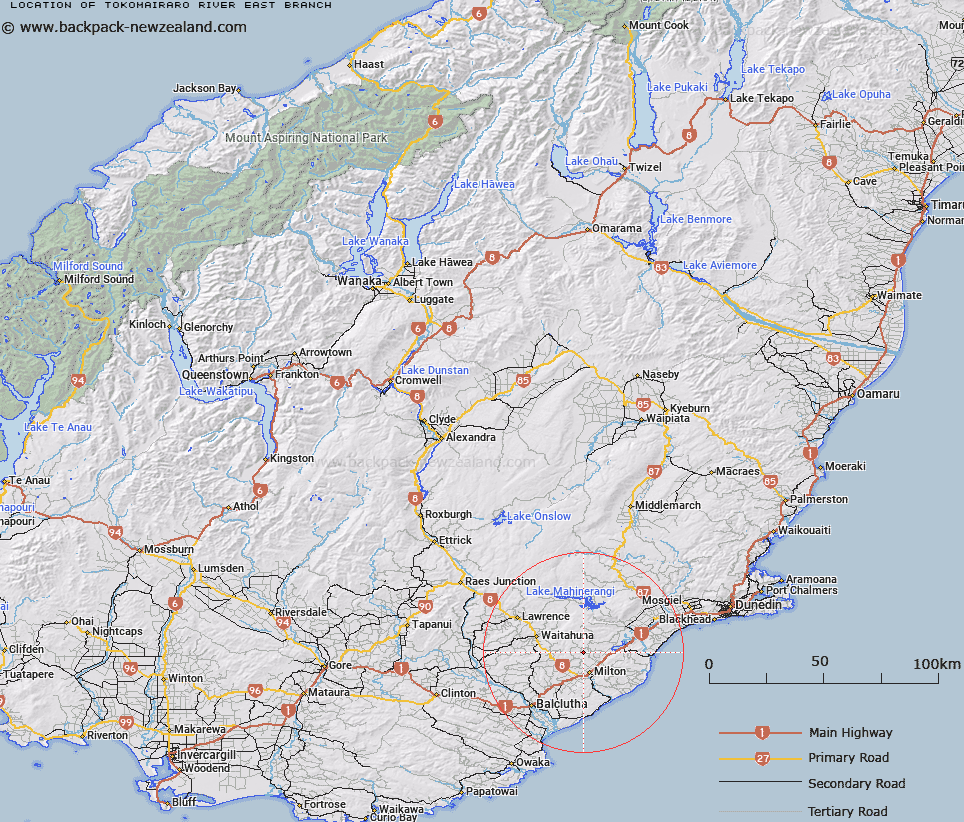
Map showing location of Tokomairaro River East Branch


LINZ description: Feature shown on: NZMS260 H45; A river flowing south then east from Berwick Forest to its confluence with Tokomairaro River West Branch, just south of Milton. NZTopo50-CE15 635062 (source) to NZTopo50-CF15 650871 (confluence).
Latitude: -46.044386
Longitude: 169.938823
Northing: 4896464.1
Easting: 1363159.6
Land District: Otago
Feat Type: Stream


Scroll down to see a more detailed road map and below that a topographical map showing the location of Tokomairaro River East Branch. The road map has been supplied by openstreetmap and the topographical map of Tokomairaro River East Branch has been supplied by Land Information New Zealand (LINZ).

Yes you can use the top static map for you school/university project or personal website with a link back. Contact me for any commercial use.

Tokomairaro River East Branch Map New Zealand


New Zealand places in our database
[ A ] [ B ] [ C ] [ D ] [ E ] [ F ] [ G ] [ H ] [ I ] [ J ] [ K ] [ L ] [ M ] [ N ] [ O ] [ P ] [ Q ] [ R ] [ S ] [ T ] [ U ] [ V ] [ W ] [ X ] [ Y ] [ Z ]


Closest 20 Streams to Tokomairaro River East Branch

Fishers Stream ( 5.27km )   Tokomairaro River West Branch ( 5.9km )   Tokomairiro River West Branch ( 5.9km )   Gorge Creek ( 6.27km )   Burn Stream ( 7.06km )   Salmonds Creek ( 8.7km )   Manuka Stream ( 9.36km )   Falla Burn ( 10.62km )   Lower Narrowdale Stream ( 10.7km )   Upper Narrowdale Stream ( 11.5km )   Meggat Burn ( 13.01km )   Dowdle Creek ( 13.93km )   Shag Creek ( 14.66km )   Bull Creek ( 14.8km )   Akatore Creek ( 15.56km )   Shepherd Stream ( 15.59km )   Frasers Stream ( 15.68km )   Bull Creek ( 15.72km )   Tokomairaro River ( 16.02km )   Tokomairiro River ( 16.02km )   Nobles Stream ( 16.16km )   Glenledi Stream ( 16.24km )   Lovells Stream ( 16.47km )   Stuart Stream ( 16.59km )   German Stream ( 16.75km )   Wangaloa Stream ( 17.48km )   Surprise Stream ( 18.41km )   Waitahuna River ( 18.44km )   Mill Creek ( 18.74km )   Rocky Valley Creek ( 18.91km )   Big Creek ( 19.02km )   Curries Stream ( 19.26km )   Bungtown Stream ( 19.45km )   Shagree Creek ( 19.68km )   Stony Creek ( 19.81km )   Wangaloa Creek ( 19.98km )   Elbow Stream ( 19.99km )   Saddle Stream ( 20.19km )   Pioneer Stream ( 20.2km )   Knee Stream ( 20.46km )