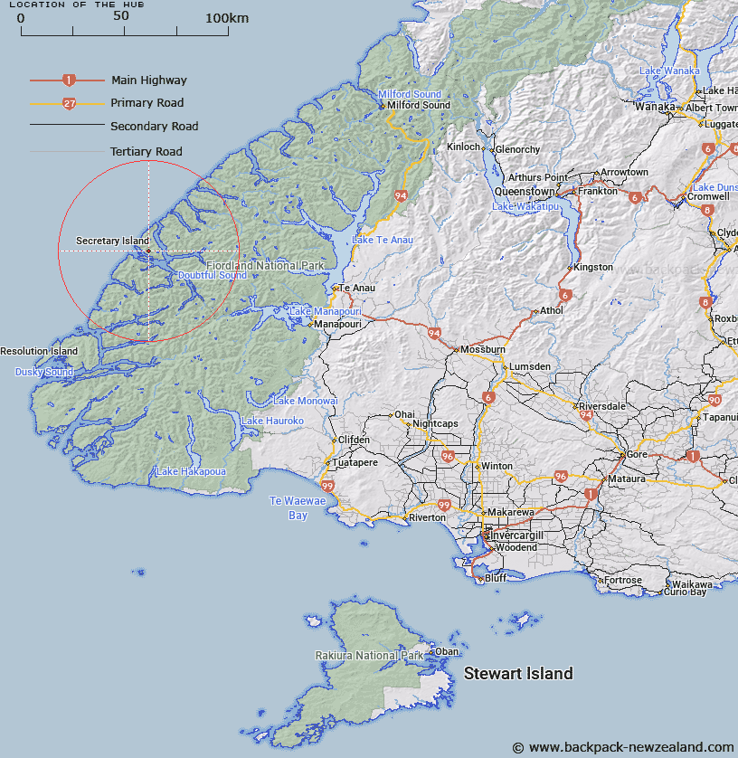
Map showing location of The Hub


LINZ description: Peak (1034m) on main ridge of Secretary Island, 2km West by North-west of Mount Grono Trig. (Geodetic Code A0DW).
Latitude: -45.260529
Longitude: 166.928406
Northing: 4970145.9
Easting: 1123647.3
Land District: Southland
Feat Type: Hill


Scroll down to see a more detailed road map and below that a topographical map showing the location of The Hub. The road map has been supplied by openstreetmap and the topographical map of The Hub has been supplied by Land Information New Zealand (LINZ).

Yes you can use the top static map for you school/university project or personal website with a link back. Contact me for any commercial use.

The Hub Map New Zealand


New Zealand places in our database
[ A ] [ B ] [ C ] [ D ] [ E ] [ F ] [ G ] [ H ] [ I ] [ J ] [ K ] [ L ] [ M ] [ N ] [ O ] [ P ] [ Q ] [ R ] [ S ] [ T ] [ U ] [ V ] [ W ] [ X ] [ Y ] [ Z ]


Closest 20 Hills to The Hub

Mount Groznoz ( 1.91km )   Mount Grono ( 1.91km )   All Round Peak ( 2.78km )   Crayfish Heights ( 8.34km )   Hamley Peak ( 9.31km )   Medley Peak ( 9.74km )   Mount Forbes ( 10.16km )   Evans Peak ( 10.89km )   Dunsterville Peaks ( 11.58km )   Mount Namu ( 13.04km )   Mount Napier ( 14.66km )   Glengarry Peak ( 15.8km )   Forden Peak ( 19.5km )   Key Peak ( 20.09km )   Command Peak ( 20.12km )   Stephens Peak ( 21.12km )   Saddle Back Peak ( 21.13km )   Rectory Peak ( 21.3km )   Depth Peak ( 22.2km )   Turn Peak ( 22.57km )   Mount Patanga ( 24.46km )   Commander Peak ( 24.64km )   Victor Peak ( 25.33km )   Coronation Peak ( 27.17km )   Calm Peak ( 27.18km )   Double Peak ( 27.31km )   Mount Wera ( 27.92km )   Mount Danae ( 28.13km )   Mount Soaker ( 28.53km )   Mount Troup ( 29.53km )   Mount Fannin ( 29.69km )   Mount Paulina ( 30.76km )   Mount Scott ( 30.82km )   Mount Kellard ( 30.84km )   Mount Baird ( 32.26km )   Ardneil Peak ( 32.31km )   Mount Fowler ( 32.49km )   Mount Hall ( 32.49km )   Mount George ( 32.52km )   Black Giants ( 32.69km )