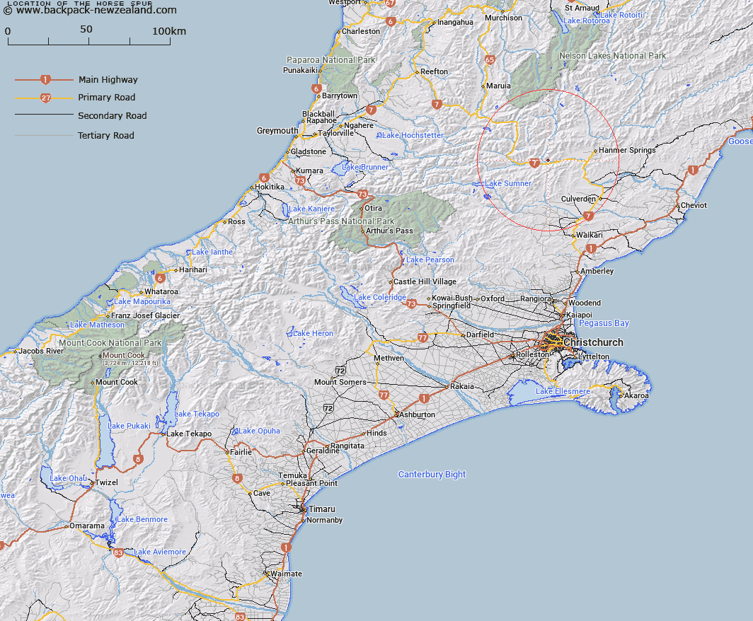
Map showing location of The Horse Spur


LINZ description: A small spur running northwest-southeast from Handyside to the Waiau River
Latitude: -42.574276
Longitude: 172.571146
Northing: 5286370.3
Easting: 1564804.5
Land District: Canterbury
Feat Type: Ridge


Scroll down to see a more detailed road map and below that a topographical map showing the location of The Horse Spur. The road map has been supplied by openstreetmap and the topographical map of The Horse Spur has been supplied by Land Information New Zealand (LINZ).

Yes you can use the top static map for you school/university project or personal website with a link back. Contact me for any commercial use.

The Horse Spur Map New Zealand


New Zealand places in our database
[ A ] [ B ] [ C ] [ D ] [ E ] [ F ] [ G ] [ H ] [ I ] [ J ] [ K ] [ L ] [ M ] [ N ] [ O ] [ P ] [ Q ] [ R ] [ S ] [ T ] [ U ] [ V ] [ W ] [ X ] [ Y ] [ Z ]


Closest 20 Ridges to The Horse Spur

Fandang Spur ( 9.63km )   Razorback ( 11.61km )   Ship Spur ( 13.89km )   The Burnt Spur ( 17.26km )   Saddle Spur ( 24.24km )   The Battery ( 31.56km )   Dog Hill ( 32.42km )   Pass Spur ( 32.87km )   Long Spur ( 33.28km )   Woolshed Ridge ( 37.21km )   Cardigan Ridge ( 37.57km )   Clay Spurs ( 40.69km )   Paget Ridge ( 43.4km )   Sebastopol Ridge ( 43.91km )   Inkerman Ridge ( 47.01km )   The Brothers ( 48.58km )   The Panhandle ( 50.46km )   Balaclava Ridge ( 51.15km )   Whales Back ( 55.58km )   Snowgrass Spur ( 55.96km )   Turk Ridge ( 56.04km )   The Sisters Ridge ( 56.37km )   Conway Spur ( 57.61km )   Franklin Ridge ( 58.58km )   Stafford Ridge ( 61.52km )   The Fingerpost ( 62.06km )   Mount Horrible Spur ( 64.95km )   Three Sisters ( 67.34km )   Jacobs Ladder ( 67.71km )   Fifteen Mile Spur ( 68.86km )   Saw Spur ( 70.99km )   Cattle Spur ( 72.28km )   Mangerton Ridge ( 72.81km )   Bald Hills ( 73.12km )   Driving Spur ( 74.8km )   Angelus Ridge ( 74.87km )   Big Benledi ( 75.24km )   Blackball Ridge ( 75.76km )   Robert Ridge ( 80.89km )   Rough Spur ( 81.21km )