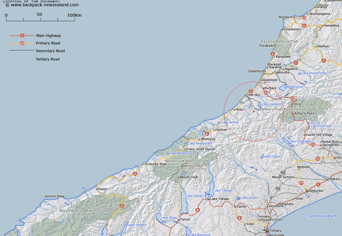
Map showing location of The Doughboy


LINZ description: Feature shown on: NZMS260-J33 518079; NZTopo50-BV18 418462;
Latitude: -42.919712
Longitude: 171.06251
Northing: 5246280
Easting: 1441870.7
Land District: Westland
Feat Type: Locality


Scroll down to see a more detailed road map and below that a topographical map showing the location of The Doughboy. The road map has been supplied by openstreetmap and the topographical map of The Doughboy has been supplied by Land Information New Zealand (LINZ).

Yes you can use the top static map for you school/university project or personal website with a link back. Contact me for any commercial use.

The Doughboy Map New Zealand


New Zealand places in our database
[ A ] [ B ] [ C ] [ D ] [ E ] [ F ] [ G ] [ H ] [ I ] [ J ] [ K ] [ L ] [ M ] [ N ] [ O ] [ P ] [ Q ] [ R ] [ S ] [ T ] [ U ] [ V ] [ W ] [ X ] [ Y ] [ Z ]


Closest 20 Localitys to The Doughboy

Kokatahi ( 10km )   Rimu ( 17.52km )   Milltown ( 17.95km )   Woodstock ( 18.01km )   Ruatapu ( 19.05km )   Kaniere ( 19.88km )   Kanieri ( 19.88km )   Ross ( 20.03km )   Arthurstown ( 20.08km )   Mananui ( 20.78km )   Humphreys ( 21.55km )   Takutai ( 22.46km )   Donoghues ( 23.04km )   Blue Spur ( 23.38km )   Ho Ho ( 25.79km )   Houhou ( 25.79km )   Kaihinu ( 27.04km )   Goldsborough (Waimea) ( 27.24km )   Fergusons ( 27.3km )   Wainihinihi ( 27.73km )   Turiwhate ( 27.77km )   Arahura ( 27.92km )   Stafford ( 28.02km )   Callaghans ( 28.75km )   Taramakau ( 29.91km )   Waitaha ( 30.05km )   Hohonu ( 30.64km )   Awatuna ( 31.59km )   Dillmanstown ( 31.8km )   Avoca Col ( 32.05km )   Kakapotahi ( 32.42km )   Pukekura ( 33.59km )   Kumara ( 33.7km )   Chesterfield ( 34.13km )   Greenstone (Pounamu) ( 35.6km )   Kumara Junction ( 37.43km )   Inchbonnie ( 39.25km )   Arthur's Pass ( 41.05km )   Arthur Pass ( 41.05km )   Mitchells ( 41.29km )