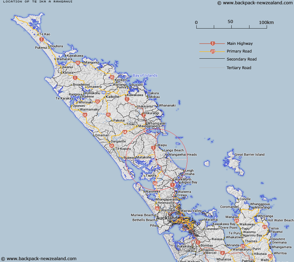
Map showing location of Te Ika a Ranganui


LINZ description: Feature shown on: NZMS260 Q08 Edition 1 1981
Latitude: -36.154306
Longitude: 174.454667
Northing: 5997956.5
Easting: 1730854.1
Land District: North Auckland
Feat Type: Site


Scroll down to see a more detailed road map and below that a topographical map showing the location of Te Ika a Ranganui. The road map has been supplied by openstreetmap and the topographical map of Te Ika a Ranganui has been supplied by Land Information New Zealand (LINZ).

Yes you can use the top static map for you school/university project or personal website with a link back. Contact me for any commercial use.
Te Ika a Ranganui Map New Zealand


New Zealand places in our database
[ A ] [ B ] [ C ] [ D ] [ E ] [ F ] [ G ] [ H ] [ I ] [ J ] [ K ] [ L ] [ M ] [ N ] [ O ] [ P ] [ Q ] [ R ] [ S ] [ T ] [ U ] [ V ] [ W ] [ X ] [ Y ] [ Z ]


Closest 20 Sites to Te Ika a Ranganui

Coates Memorial ( 6.87km )   Ng?roto ( 16.53km )   Moran Lookout ( 31.36km )   Tawhiri Pa ( 33.66km )   Pouto Marae ( 34.1km )   Mahipatua Pa ( 35.9km )   Rangitane Pa ( 37.21km )   Muriwai Pa ( 39.25km )   Ihawhanui Pa ( 39.81km )   Mansion House ( 44.83km )   Repia Marae ( 45.88km )   Awahoa Pa ( 46.54km )   Huitau Pa ( 47.94km )   Pukeatua Pa ( 48.27km )   Waipuna Pa ( 48.43km )   Te Rite-a-Kawharu P? ( 49.45km )   Okoihu Pa ( 52.99km )   Te Hue Pa ( 53.68km )   Oturei Marae ( 53.7km )   Parihakoakoa Pa ( 54.05km )   Kaikai P? ( 54.89km )   Hiorekata ( 65.48km )   Tauwhare ( 65.71km )   Kahukur? ( 67.59km )   Captain Bouganville Monument ( 68.99km )   Whakapaumahara Marae ( 72.17km )   Te Rearea Pa ( 78.68km )   Okurekureia Pa ( 79.42km )   Te Maurea Pa ( 80.51km )   Ko Otama Pa ( 81.13km )   Pukehune Pa ( 81.88km )   Mataitaua Pa ( 82.26km )   Poutukiterangi Pa ( 83.52km )   Mokau Marae ( 83.68km )   Savage Memorial ( 83.77km )   Ewelme Cottage ( 84.07km )   Mahingutu Pa ( 84.12km )   Taurangaokahu ( 84.23km )   Takapurua Pa ( 84.42km )   Puatamaroa Pa ( 84.6km )