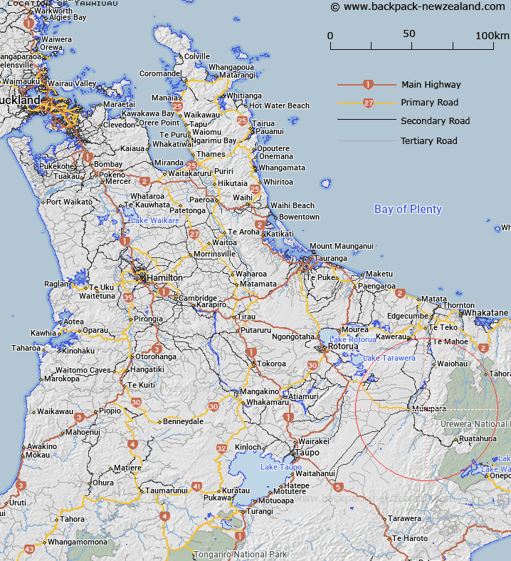
Map showing location of Tawhiuau
LINZ description: Hill (1017m) and Trig. Station 2120 (Geodetic Code 2319), in the Galatea area, 1.4km South-west of hill Takapakapa. Block XIV Galatea Survey District.
Latitude: -38.457953
Longitude: 176.799716
Northing: 5736528.6
Easting: 1931575.1
Land District: South Auckland
Feat Type: Trig Station
Latitude: -38.457953
Longitude: 176.799716
Northing: 5736528.6
Easting: 1931575.1
Land District: South Auckland
Feat Type: Trig Station

Scroll down to see a more detailed road map and below that a topographical map showing the location of Tawhiuau. The road map has been supplied by openstreetmap and the topographical map of Tawhiuau has been supplied by Land Information New Zealand (LINZ).
Yes you can use the top static map for you school/university project or personal website with a link back. Contact me for any commercial use.
[ A ] [ B ] [ C ] [ D ] [ E ] [ F ] [ G ] [ H ] [ I ] [ J ] [ K ] [ L ] [ M ] [ N ] [ O ] [ P ] [ Q ] [ R ] [ S ] [ T ] [ U ] [ V ] [ W ] [ X ] [ Y ] [ Z ]