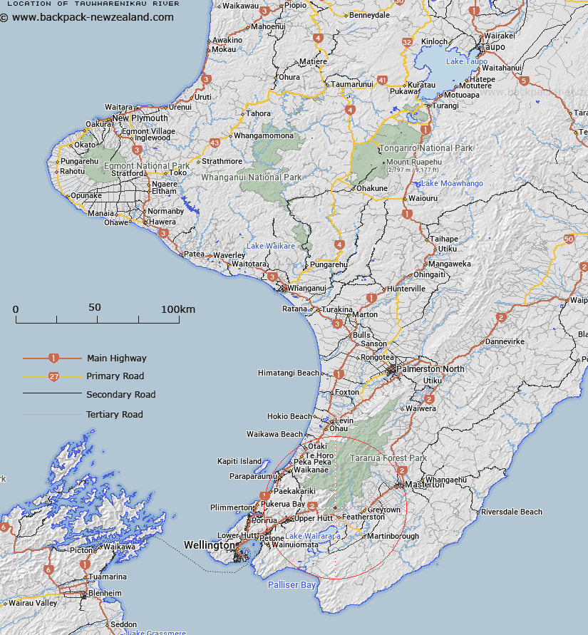
Map showing location of Tauwharenikau River


LINZ description: A river that flows generally south, for approximately 40km, from near the summit of Mount Hector to its mouth at the northeast end of Lake Wairarapa. NZTopo50-BP33 922640 to BQ33 943388
Latitude: -41.065535
Longitude: 175.304288
Northing: 5451409.6
Easting: 1793609.3
Land District: Wellington
Feat Type: Stream


Scroll down to see a more detailed road map and below that a topographical map showing the location of Tauwharenikau River. The road map has been supplied by openstreetmap and the topographical map of Tauwharenikau River has been supplied by Land Information New Zealand (LINZ).

Yes you can use the top static map for you school/university project or personal website with a link back. Contact me for any commercial use.

Tauwharenikau River Map New Zealand


New Zealand places in our database
[ A ] [ B ] [ C ] [ D ] [ E ] [ F ] [ G ] [ H ] [ I ] [ J ] [ K ] [ L ] [ M ] [ N ] [ O ] [ P ] [ Q ] [ R ] [ S ] [ T ] [ U ] [ V ] [ W ] [ X ] [ Y ] [ Z ]


Closest 20 Streams to Tauwharenikau River

Bates Stream ( 2.8km )   Wiersma Stream ( 3.07km )   Canyon Creek ( 3.38km )   Fell Creek ( 3.48km )   Fan Stream ( 3.48km )   Shepperds Stream ( 3.66km )   Marchant Stream ( 3.9km )   Boar Creek ( 4.09km )   Rodgers Stream ( 4.22km )   Smith Creek ( 4.41km )   Boulder Stream ( 4.66km )   Blue Rock Stream ( 5.12km )   Slip Stream ( 5.3km )   Taits Stream ( 5.47km )   Abbots Creek ( 5.49km )   Kotukutuku Stream ( 6.06km )   Gorge Stream ( 6.23km )   Tutuwai Stream ( 6.26km )   Phillips Stream ( 6.51km )   Eastern Hutt River ( 6.67km )   Farm Creek ( 7.07km )   Omega Creek ( 7.19km )   Reeves Stream ( 7.33km )   Quoin Stream ( 7.66km )   Puffer Creek ( 7.83km )   Prince Stream ( 8.02km )   Sunny Stream ( 8.33km )   Bull Mound Creek ( 8.46km )   Otauira Stream ( 8.48km )   Coal Stream ( 8.49km )   Stonestead Creek ( 8.67km )   Remutaka Stream ( 8.85km )   Rimutaka Stream ( 8.85km )   Owhanga Stream ( 9.32km )   Western Hutt River ( 9.83km )   Clem Stream ( 10.91km )   Roaring Stream ( 10.91km )   Josephson Creek ( 10.98km )   Devil Creek ( 11.02km )   Kaitoke Stream ( 11.15km )