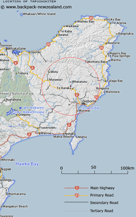
Map showing location of Tapuihikitea
LINZ description: Located on western riverbank of Waipaoa River. Approximately 4km north-west from Te Karaka.
Latitude: -38.438747
Longitude: 177.838743
Northing: 5734400
Easting: 2022400
Land District: Gisborne
Feat Type: Locality
Latitude: -38.438747
Longitude: 177.838743
Northing: 5734400
Easting: 2022400
Land District: Gisborne
Feat Type: Locality

Scroll down to see a more detailed road map and below that a topographical map showing the location of Tapuihikitea. The road map has been supplied by openstreetmap and the topographical map of Tapuihikitea has been supplied by Land Information New Zealand (LINZ).
Yes you can use the top static map for you school/university project or personal website with a link back. Contact me for any commercial use.
[ A ] [ B ] [ C ] [ D ] [ E ] [ F ] [ G ] [ H ] [ I ] [ J ] [ K ] [ L ] [ M ] [ N ] [ O ] [ P ] [ Q ] [ R ] [ S ] [ T ] [ U ] [ V ] [ W ] [ X ] [ Y ] [ Z ]