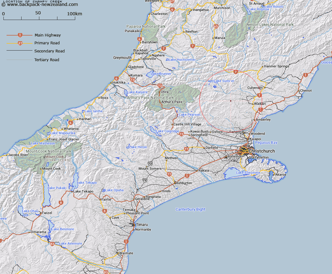
Map showing location of Swampy Creek


LINZ description: Flows north-easterly into North Branch, Waipara River, about 400 above its junction with Melrose Stream. Okuku Survey District.
Latitude: -42.930694
Longitude: 172.438409
Northing: 5246728.5
Easting: 1554174.2
Land District: Canterbury
Feat Type: Stream


Scroll down to see a more detailed road map and below that a topographical map showing the location of Swampy Creek. The road map has been supplied by openstreetmap and the topographical map of Swampy Creek has been supplied by Land Information New Zealand (LINZ).

Yes you can use the top static map for you school/university project or personal website with a link back. Contact me for any commercial use.

Swampy Creek Map New Zealand


New Zealand places in our database
[ A ] [ B ] [ C ] [ D ] [ E ] [ F ] [ G ] [ H ] [ I ] [ J ] [ K ] [ L ] [ M ] [ N ] [ O ] [ P ] [ Q ] [ R ] [ S ] [ T ] [ U ] [ V ] [ W ] [ X ] [ Y ] [ Z ]


Closest 20 Streams to Swampy Creek

Swampy Creek ( 0km )   Waipapa River North Branch ( 0.95km )   Melrose Stream ( 2.36km )   Tommys Stream ( 3.04km )   Cabin Stream ( 3.57km )   Hilton Stream ( 4.35km )   Kashmir Stream ( 4.36km )   Dyfryn Stream ( 5.47km )   Teardrop Stream ( 5.75km )   Manilla Stream ( 6km )   Deadwood Stream ( 6.01km )   Leaseman Stream ( 6.29km )   Matagouri Stream ( 6.34km )   Bridge Creek ( 6.47km )   Taruna Stream ( 6.7km )   Little Bush Stream ( 6.89km )   Big Bush Stream ( 6.93km )   Waipara River North Branch ( 7.89km )   Chinsurah Stream ( 7.92km )   Waipara River Middle Branch ( 8.59km )   Heathstock Stream ( 8.93km )   Surveyors Stream ( 9.14km )   Virginia Stream ( 9.34km )   Jacks Stream ( 9.54km )   Waitohi River ( 9.75km )   Stokes Stream ( 10.55km )   Double End Stream ( 10.61km )   Retreat Creek ( 10.86km )   Dust Stream ( 11.3km )   Mulligan Stream ( 11.57km )   Hut Branch ( 11.64km )   Whistling Creek ( 11.68km )   Blue Mountain Stream ( 11.83km )   Woodchopper Stream ( 12.13km )   Washpen Stream ( 12.15km )   Seaward River ( 12.17km )   Spring Stream ( 12.48km )   Waipara River South Branch ( 12.7km )   Horseshoe Stream ( 13.06km )   Trumper Stream ( 13.26km )