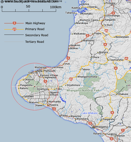
Map showing location of Surrey Road Entrance
LINZ description: Entrance to crater on north east side of Mount Taranaki or Mount Egmont.
Latitude: -39.295539
Longitude: 174.064251
Northing: 5649886.5
Easting: 1691771.9
Land District: Taranaki
Feat Type: Track
Latitude: -39.295539
Longitude: 174.064251
Northing: 5649886.5
Easting: 1691771.9
Land District: Taranaki
Feat Type: Track

Scroll down to see a more detailed road map and below that a topographical map showing the location of Surrey Road Entrance. The road map has been supplied by openstreetmap and the topographical map of Surrey Road Entrance has been supplied by Land Information New Zealand (LINZ).
Yes you can use the top static map for you school/university project or personal website with a link back. Contact me for any commercial use.
[ A ] [ B ] [ C ] [ D ] [ E ] [ F ] [ G ] [ H ] [ I ] [ J ] [ K ] [ L ] [ M ] [ N ] [ O ] [ P ] [ Q ] [ R ] [ S ] [ T ] [ U ] [ V ] [ W ] [ X ] [ Y ] [ Z ]