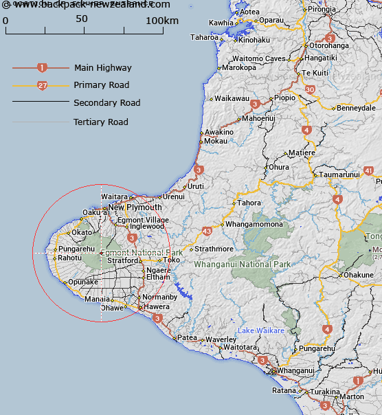
Map showing location of Summer Entrance
LINZ description: Entrance to the crater at the top of The Lizard as shown on Infomap 273-09
Latitude: -39.295345
Longitude: 174.063898
Northing: 5649908.3
Easting: 1691741.7
Land District: Taranaki
Feat Type: Track
Latitude: -39.295345
Longitude: 174.063898
Northing: 5649908.3
Easting: 1691741.7
Land District: Taranaki
Feat Type: Track

Scroll down to see a more detailed road map and below that a topographical map showing the location of Summer Entrance. The road map has been supplied by openstreetmap and the topographical map of Summer Entrance has been supplied by Land Information New Zealand (LINZ).
Yes you can use the top static map for you school/university project or personal website with a link back. Contact me for any commercial use.
[ A ] [ B ] [ C ] [ D ] [ E ] [ F ] [ G ] [ H ] [ I ] [ J ] [ K ] [ L ] [ M ] [ N ] [ O ] [ P ] [ Q ] [ R ] [ S ] [ T ] [ U ] [ V ] [ W ] [ X ] [ Y ] [ Z ]