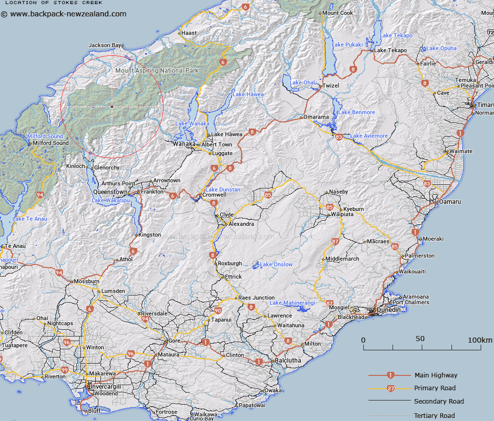
Map showing location of Stokes Creek


LINZ description: A small tributary of the Arawhata River 1km upstream from Phantom Creek
Latitude: -44.406198
Longitude: 168.538802
Northing: 5073323
Easting: 1244768.9
Land District: Otago
Feat Type: Stream


Scroll down to see a more detailed road map and below that a topographical map showing the location of Stokes Creek. The road map has been supplied by openstreetmap and the topographical map of Stokes Creek has been supplied by Land Information New Zealand (LINZ).

Yes you can use the top static map for you school/university project or personal website with a link back. Contact me for any commercial use.

Stokes Creek Map New Zealand


New Zealand places in our database
[ A ] [ B ] [ C ] [ D ] [ E ] [ F ] [ G ] [ H ] [ I ] [ J ] [ K ] [ L ] [ M ] [ N ] [ O ] [ P ] [ Q ] [ R ] [ S ] [ T ] [ U ] [ V ] [ W ] [ X ] [ Y ] [ Z ]


Closest 20 Streams to Stokes Creek

Phantom Creek ( 1.33km )   Mercer Stream ( 2.81km )   Snowball Creek ( 3.32km )   Fez Creek ( 5.08km )   South Snowball Creek ( 6.28km )   Yashmak Creek ( 6.66km )   The Bascand ( 7.5km )   The Purser ( 8.03km )   The Wilson ( 8.11km )   Topsey Creek ( 8.28km )   Response Torrent ( 8.38km )   Ridge Creek ( 8.39km )   Williamson River ( 8.68km )   Ten Hour Gorge Creek ( 8.86km )   Eros Creek ( 8.92km )   Tornado Creek ( 8.98km )   Cabin Pass Rapids ( 9.23km )   Halfway Creek ( 9.27km )   Cat O'Nine Tails ( 9.3km )   The Five Fingers ( 9.3km )   The Steward ( 9.43km )   Collins Creek ( 9.58km )   Liverpool Stream ( 9.74km )   Pass Creek ( 9.87km )   The Fireman ( 10.28km )   Whitbourn River ( 10.48km )   The Bignell ( 10.53km )   Slate Creek ( 10.93km )   The Binnacle ( 10.96km )   Rough Creek ( 11.12km )   Blue Duck River ( 11.19km )   Joe River ( 11.44km )   Cascade Creek ( 11.48km )   The Funnel ( 11.6km )   The Grease Pot ( 11.94km )   Victor Creek ( 12.1km )   The Stoker ( 12.17km )   Moore Creek ( 12.51km )   McTavish Creek ( 12.69km )   Retreat Creek ( 12.93km )