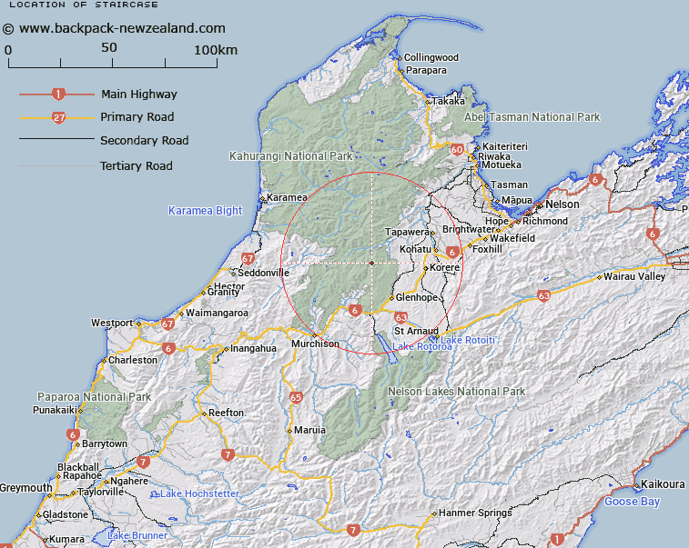
Map showing location of Staircase


LINZ description: Part of track from Blue Creek to Courthouse Flat Hut
Latitude: -41.50691
Longitude: 172.566433
Northing: 5404877.9
Easting: 1563817.1
Land District: Nelson
Feat Type: Place


Scroll down to see a more detailed road map and below that a topographical map showing the location of Staircase. The road map has been supplied by openstreetmap and the topographical map of Staircase has been supplied by Land Information New Zealand (LINZ).

Yes you can use the top static map for you school/university project or personal website with a link back. Contact me for any commercial use.

Staircase Map New Zealand


New Zealand places in our database
[ A ] [ B ] [ C ] [ D ] [ E ] [ F ] [ G ] [ H ] [ I ] [ J ] [ K ] [ L ] [ M ] [ N ] [ O ] [ P ] [ Q ] [ R ] [ S ] [ T ] [ U ] [ V ] [ W ] [ X ] [ Y ] [ Z ]


Closest 20 Places to Staircase

The Forks ( 30.78km )   Inwood Lookout ( 31.36km )   Scobie Clearing ( 37.94km )   Murchison ( 38.27km )   Hampden ( 38.27km )   Upper Junction ( 39.45km )   Lower Junction ( 41.37km )   Zalatown ( 51.66km )   Richmond ( 54.88km )   Motueka ( 57.64km )   Stoke ( 59.42km )   Bobs Lookout ( 59.62km )   Granity ( 60.71km )   Torea ( 60.71km )   Nelson ( 65.12km )   Downies Clearing ( 65.84km )   The Forks ( 66.86km )   Windy Point ( 67.09km )   Hells Gate ( 67.65km )   Lookout Point ( 68.07km )   Turkeys Nest ( 68.7km )   The Drop Off ( 73.83km )   Jacobs Ladder ( 74.64km )   Pretty Bridge ( 74.67km )   Julias Rescue ( 85.3km )   Westport ( 86.15km )   Reefton ( 89.48km )   Stanley Vale ( 89.67km )   Zig Zag ( 89.69km )   Craigs Clearing ( 93.45km )   The Peninsula ( 98.12km )   Waikaki ( 98.62km )   Waterloo Plains ( 100.53km )   Conders Bend ( 102.87km )   The Desert ( 112.6km )   Hanmer ( 115.22km )   Hanmer Springs ( 115.22km )   Hurleys Clearing ( 115.26km )   Blenheim ( 115.86km )   Pfaffs Clearing ( 117.69km )