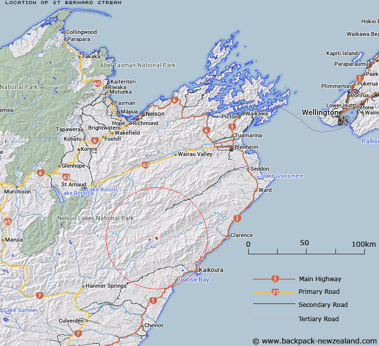
Map showing location of St Bernard Stream


LINZ description: South-west flowing stream that runs between St Bernard Spur and Sough Spur to join Elliot Stream.
Latitude: -42.173922
Longitude: 173.387264
Northing: 5330840.6
Easting: 1631984.8
Land District: Marlborough
Feat Type: Stream


Scroll down to see a more detailed road map and below that a topographical map showing the location of St Bernard Stream. The road map has been supplied by openstreetmap and the topographical map of St Bernard Stream has been supplied by Land Information New Zealand (LINZ).

Yes you can use the top static map for you school/university project or personal website with a link back. Contact me for any commercial use.

St Bernard Stream Map New Zealand


New Zealand places in our database
[ A ] [ B ] [ C ] [ D ] [ E ] [ F ] [ G ] [ H ] [ I ] [ J ] [ K ] [ L ] [ M ] [ N ] [ O ] [ P ] [ Q ] [ R ] [ S ] [ T ] [ U ] [ V ] [ W ] [ X ] [ Y ] [ Z ]


Closest 20 Streams to St Bernard Stream

Two Mile Stream ( 1.36km )   Elliott Stream ( 1.57km )   Lizard Stream ( 2.33km )   Tinkers Gully Stream ( 4.36km )   Shanty Gully Stream ( 4.71km )   Goat Valley Stream ( 4.93km )   Spray Stream ( 5.24km )   Rough Stream ( 5.4km )   Tone River ( 6.35km )   Nicholson Stream ( 6.66km )   Tytler Stream ( 7km )   The Fell ( 7.29km )   Red Hill Stream ( 7.72km )   Gregs Stream ( 8.23km )   Seymour or Herring Stream ( 8.33km )   Ottley Stream ( 9.5km )   Roaring Meg Stream ( 9.86km )   Limestone Stream ( 9.96km )   Nesbit Stream ( 10.24km )   Grasseed Stream ( 11.32km )   Thomas Stream ( 11.39km )   Gentle Annie Stream ( 11.63km )   Yeo Stream ( 11.64km )   Willows Stream ( 11.87km )   Cold Stream ( 11.88km )   Dane River ( 12.07km )   William Stream ( 12.23km )   Black Rock Stream ( 12.45km )   Robinson Creek ( 12.88km )   Weka Brook ( 13.07km )   Tweed River ( 13.37km )   Smokey Stream ( 13.76km )   Lacebark Stream ( 14.03km )   Gloster River ( 14.24km )   Split Rock Stream ( 14.57km )   Ward Stream ( 14.77km )   Dubious Stream ( 14.84km )   Cow Stream ( 14.89km )   Waiau Toa / Clarence River ( 15.05km )   Clarence River ( 15.05km )