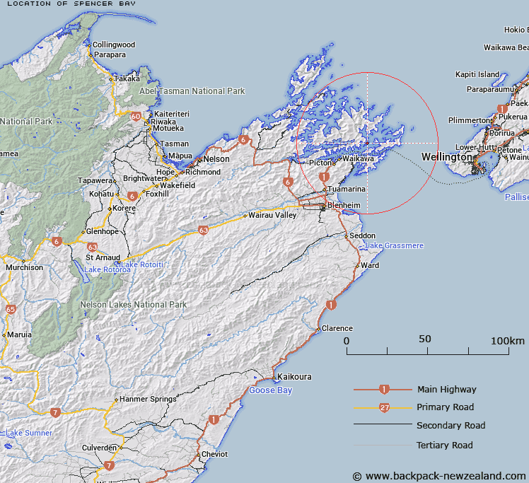
Map showing location of Spencer Bay


LINZ description: Bay in Queen Charlotte Sound, West of Kurakura Point, and 2.75km North-east of Snake Point. Arapawa Survey District.
Latitude: -41.183437
Longitude: 174.192813
Northing: 5440193.7
Easting: 1700039.7
Land District: Marlborough
Feat Type: Bay


Scroll down to see a more detailed road map and below that a topographical map showing the location of Spencer Bay. The road map has been supplied by openstreetmap and the topographical map of Spencer Bay has been supplied by Land Information New Zealand (LINZ).

Yes you can use the top static map for you school/university project or personal website with a link back. Contact me for any commercial use.

Spencer Bay Map New Zealand


New Zealand places in our database
[ A ] [ B ] [ C ] [ D ] [ E ] [ F ] [ G ] [ H ] [ I ] [ J ] [ K ] [ L ] [ M ] [ N ] [ O ] [ P ] [ Q ] [ R ] [ S ] [ T ] [ U ] [ V ] [ W ] [ X ] [ Y ] [ Z ]


Closest 20 Bays to Spencer Bay

Longfellow Bay ( 0.92km )   Dryden Bay ( 1.13km )   Milton Bay ( 1.26km )   Cherry Bay ( 1.4km )   Cockle Cove ( 1.64km )   Cockle Bay ( 1.64km )   Mint Bay ( 2.12km )   Pope Bay ( 2.58km )   Chaucer Bay ( 2.82km )   Bay of Many Coves (Miritu Bay) ( 2.9km )   Bakers Bay ( 3.2km )   Aratawa Bay ( 3.41km )   Arthurs Bay ( 3.47km )   Umuwheke Bay ( 3.54km )   Double Bay ( 3.65km )   Ahitarakihi Bay ( 3.99km )   Deep Bay ( 4.55km )   Waikakaramea Bay ( 4.83km )   Kaitapeha Bay ( 4.93km )   Te Ipapakereru Bay ( 5.17km )   Ngaruru Bay ( 5.23km )   Te Iro Bay ( 5.82km )   Pirapu Bay ( 5.82km )   Endeavour Inlet ( 6.13km )   Ruakaka Bay ( 6.21km )   Tawa Bay ( 6.32km )   Deep Bay ( 6.45km )   Konini Bay ( 6.6km )   Wairakau Bay ( 6.86km )   Moriori Bay ( 6.94km )   Cherry Bay ( 6.98km )   Ratimera Bay ( 7.05km )   Te Weka Bay ( 7.09km )   Wharehunga Bay ( 7.18km )   Kahika Bay ( 7.19km )   Resolution Bay ( 7.22km )   Camp Bay ( 7.32km )   Ngamahau Bay ( 7.49km )   Te Weuweu Bay ( 7.52km )   Erie Bay ( 7.65km )