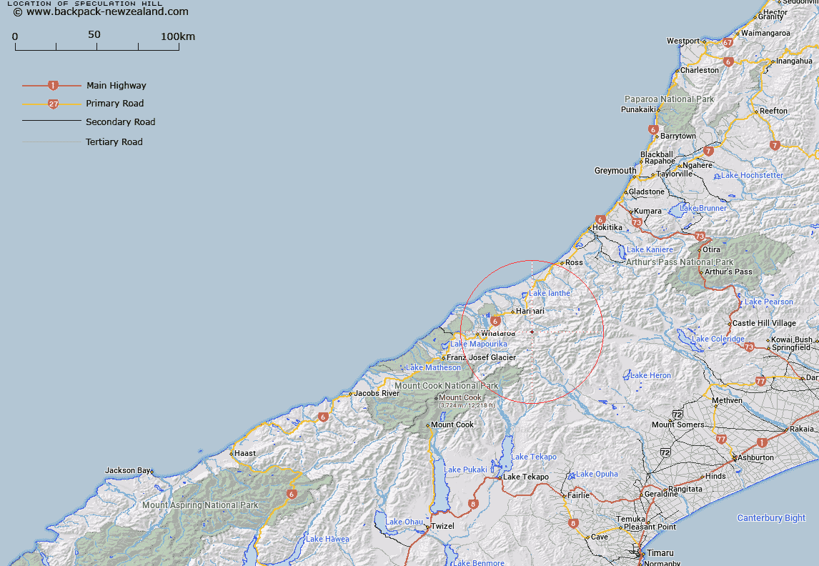
Map showing location of Speculation Hill


LINZ description: East of the Southern Alps / Kā Tiritiri o te Moana north of the Wilbur Range.
Latitude: -43.250514
Longitude: 170.656996
Northing: 5208700
Easting: 1409800
Land District: Westland
Feat Type: Hill


Scroll down to see a more detailed road map and below that a topographical map showing the location of Speculation Hill. The road map has been supplied by openstreetmap and the topographical map of Speculation Hill has been supplied by Land Information New Zealand (LINZ).

Yes you can use the top static map for you school/university project or personal website with a link back. Contact me for any commercial use.

Speculation Hill Map New Zealand


New Zealand places in our database
[ A ] [ B ] [ C ] [ D ] [ E ] [ F ] [ G ] [ H ] [ I ] [ J ] [ K ] [ L ] [ M ] [ N ] [ O ] [ P ] [ Q ] [ R ] [ S ] [ T ] [ U ] [ V ] [ W ] [ X ] [ Y ] [ Z ]


Closest 20 Hills to Speculation Hill

Mount Tri ( 1.92km )   Smith Peak ( 2.31km )   Tri Peak ( 2.59km )   Avalon Peak ( 3.19km )   Mount Kensington ( 4.77km )   Mount Hulka ( 6.04km )   Mount Farrar ( 6.7km )   Artemis Peak ( 7.48km )   Mount Ferguson ( 7.62km )   Guardian Peak ( 7.86km )   Barlow Peak ( 8.13km )   Bryan Hill ( 8.27km )   Mount Lambert ( 8.33km )   Mount Wilberg ( 8.73km )   Mount Willberg ( 8.73km )   Newton Peak ( 8.78km )   Little Unknown ( 8.95km )   Mount Tyndall ( 9.29km )   Blue Lookout ( 9.64km )   False Blue Lookout ( 10km )   Snowy Peak ( 10.11km )   Mirage Knob ( 10.41km )   Kea Knob ( 10.46km )   Baker Peak ( 10.47km )   Mount Adams ( 10.69km )   The Great Unknown Peak ( 10.78km )   The Great Unknown ( 10.8km )   Sceptre Peak ( 11.21km )   Outram Peak ( 11.22km )   Schrund Peak ( 11.32km )   Mount Durward ( 11.35km )   Quoin Peak ( 11.36km )   Mount Stoddart ( 11.4km )   Mount Moreton ( 11.58km )   Mount Ashmore ( 12.29km )   Mount Smyth ( 12.95km )   Mount Edison ( 13.47km )   Trireme Peak ( 13.83km )   Veil Peak ( 13.89km )   Malcolm Peak ( 14.05km )