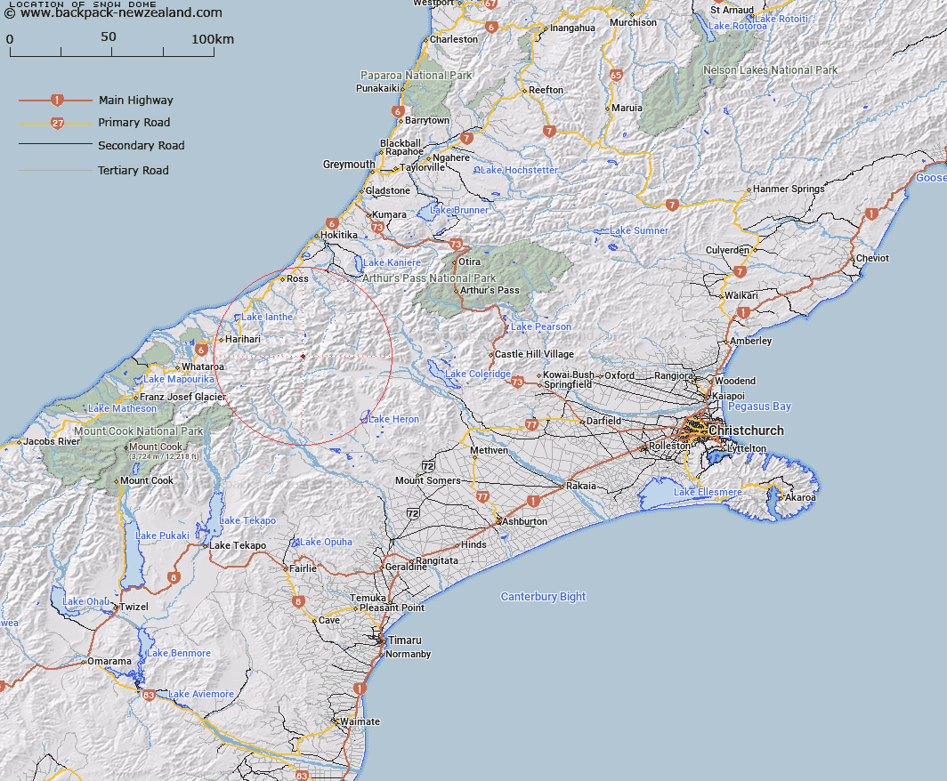
Map showing location of Snow Dome


LINZ description: Peak in the Upper Rakaia District of the Southern Alps/Kā Tiritiri o te Moana. West of Mount Whitcombe and above the Leeb Glacier.
Latitude: -43.215042
Longitude: 170.90688
Northing: 5213177.8
Easting: 1429987
Land District: Canterbury
Feat Type: Hill


Scroll down to see a more detailed road map and below that a topographical map showing the location of Snow Dome. The road map has been supplied by openstreetmap and the topographical map of Snow Dome has been supplied by Land Information New Zealand (LINZ).

Yes you can use the top static map for you school/university project or personal website with a link back. Contact me for any commercial use.

Snow Dome Map New Zealand


New Zealand places in our database
[ A ] [ B ] [ C ] [ D ] [ E ] [ F ] [ G ] [ H ] [ I ] [ J ] [ K ] [ L ] [ M ] [ N ] [ O ] [ P ] [ Q ] [ R ] [ S ] [ T ] [ U ] [ V ] [ W ] [ X ] [ Y ] [ Z ]


Closest 20 Hills to Snow Dome

Mount Whitcombe ( 0.49km )   Erewhon Peak ( 1.13km )   The Red Lion ( 2.98km )   Mount Roberts ( 2.99km )   Amazons Breasts ( 3.48km )   Louper Peak ( 3.57km )   Lauper Peak ( 3.57km )   Mount Evans ( 3.62km )   Mount Butler ( 4.38km )   Mount Lord ( 4.49km )   Mueller Peak ( 5.84km )   Artist Dome ( 6.07km )   Agfa Knob ( 6.21km )   Jourdain Cone ( 6.27km )   Park Dome ( 6.42km )   Dan Peak ( 6.48km )   Mount Westland ( 6.5km )   Mount Ramsay ( 6.67km )   Jims Knob ( 7.16km )   Mount Blomfield ( 7.69km )   Mount Bloomfield ( 7.69km )   Mount Barry ( 8.28km )   Mount Thorndike ( 8.28km )   Mount Kinkel ( 8.52km )   Blair Peak ( 8.56km )   Meins Knob ( 8.81km )   Mount Neville ( 9.11km )   Mount Neave ( 9.66km )   Mount Van Redan ( 9.98km )   Mount Smyth ( 10.08km )   Hidden Peak ( 10.23km )   Mount Wylde Brown ( 10.89km )   Mount Murray ( 10.9km )   Laws Peak ( 10.96km )   Blue Lookout ( 11.11km )   Johanson Peak ( 11.24km )   Raged Peak ( 11.32km )   Observation Cone ( 11.34km )   False Blue Lookout ( 11.36km )   Malcolm Peak ( 11.91km )