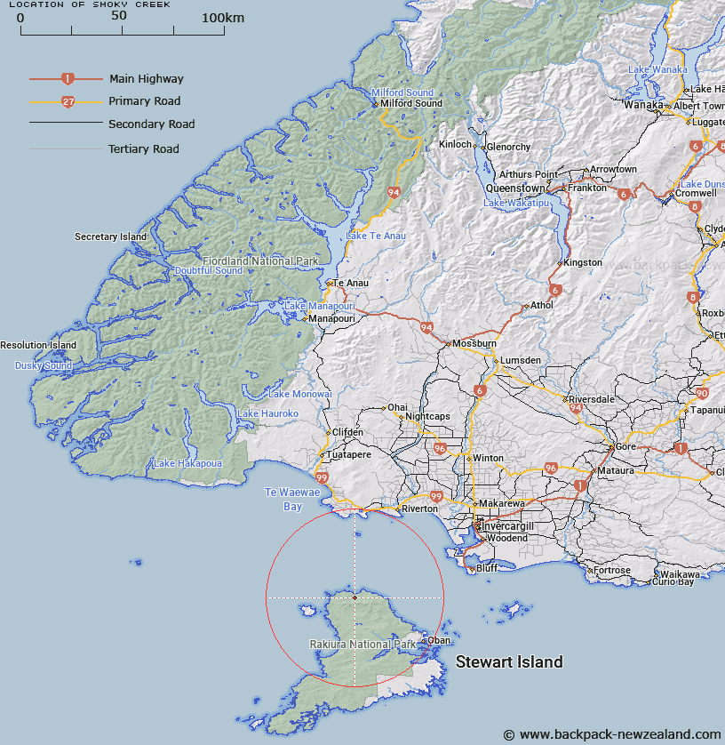
Map showing location of Smoky Creek


LINZ description: Stream rising 7km West of Mount Anglem, with it's outlet at Smoky Beach, north coast of Stewart Island. Anglem Survey District.
Latitude: -46.718379
Longitude: 167.832286
Northing: 4813148.6
Easting: 1205094
Land District: Southland
Feat Type: Stream


Scroll down to see a more detailed road map and below that a topographical map showing the location of Smoky Creek. The road map has been supplied by openstreetmap and the topographical map of Smoky Creek has been supplied by Land Information New Zealand (LINZ).

Yes you can use the top static map for you school/university project or personal website with a link back. Contact me for any commercial use.

Smoky Creek Map New Zealand


New Zealand places in our database
[ A ] [ B ] [ C ] [ D ] [ E ] [ F ] [ G ] [ H ] [ I ] [ J ] [ K ] [ L ] [ M ] [ N ] [ O ] [ P ] [ Q ] [ R ] [ S ] [ T ] [ U ] [ V ] [ W ] [ X ] [ Y ] [ Z ]


Closest 20 Streams to Smoky Creek

Yankee River ( 4.66km )   Ruggedy Stream ( 6.11km )   Ruggedy River ( 6.11km )   Murray River ( 13.25km )   Forked Creek ( 13.31km )   Freshwater River ( 15.59km )   Scott Burn ( 16.83km )   Topeheti Creek ( 21.27km )   Tolson River ( 22.11km )   Little River ( 22.11km )   Duck Creek ( 23.36km )   Duck Creek ( 23.84km )   Martins Creek ( 24.89km )   Double Creek ( 26.06km )   Little River ( 26.62km )   Wreck Creek ( 27.33km )   Mill Creek ( 27.73km )   Ogles Creek ( 28.14km )   Cavalier Creek ( 28.59km )   Ryans Creek ( 28.79km )   Rakeahua River ( 29.88km )   Leask Creek ( 30.45km )   Euchre Creek ( 30.78km )   Waterfall Creek ( 32.57km )   Gorge Creek ( 38.52km )   Doughboy Creek ( 38.87km )   Blaikies Creek ( 40.18km )   Kirklands Creek ( 40.21km )   Pouahiri Creek ( 40.21km )   Toitoi River ( 40.39km )   Heron River ( 41.13km )   Chew Tobacco Creek ( 41.6km )   Ouki Creek ( 42.39km )   Ourawera Stream ( 43.3km )   Newton Creek ( 43.41km )   Rurikaka Creek ( 43.45km )   Kopeka River ( 43.84km )   Bullers Creek ( 43.91km )   Lords River ( 44.08km )   Lords River/T?taekawetoweto ( 44.08km )