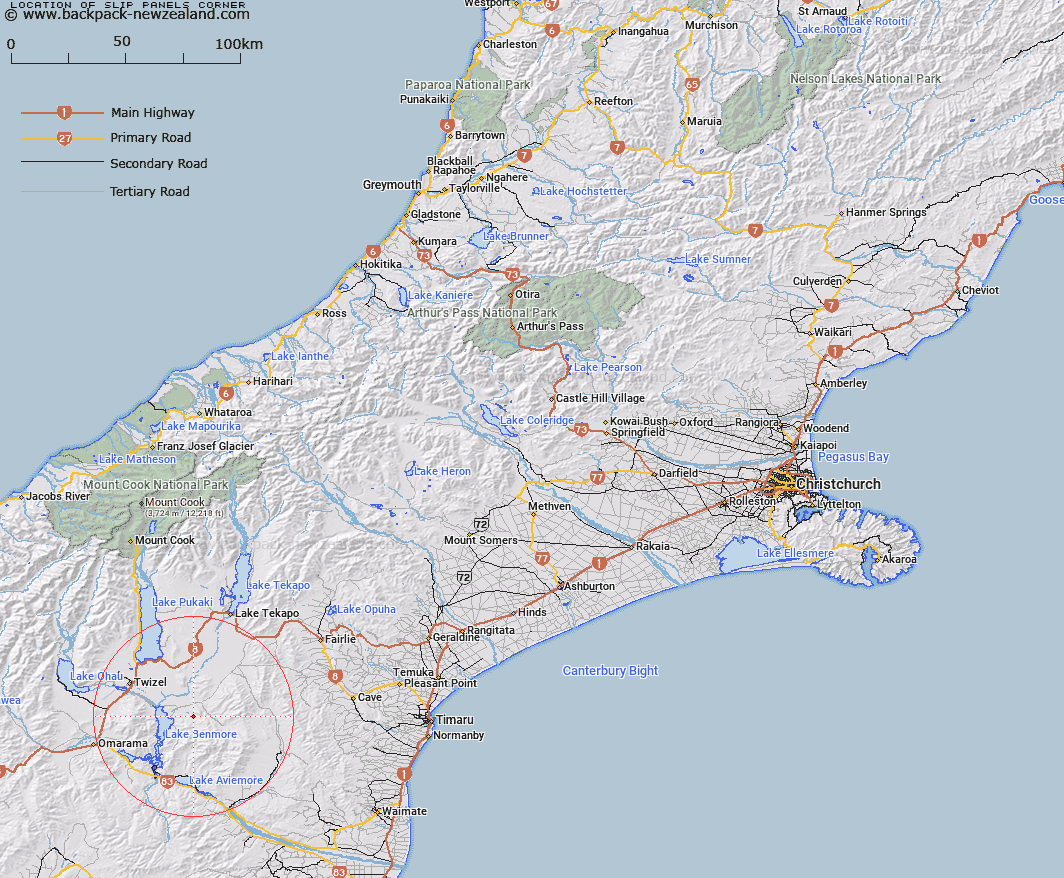
Map showing location of Slip Panels Corner


LINZ description: Place at the confluence of Ross Stream and Stony River, approximately 5miles east of Lake Benmore.
Latitude: -44.379476
Longitude: 170.342286
Northing: 5082542.6
Easting: 1388281.1
Land District: Canterbury
Feat Type: Place


Scroll down to see a more detailed road map and below that a topographical map showing the location of Slip Panels Corner. The road map has been supplied by openstreetmap and the topographical map of Slip Panels Corner has been supplied by Land Information New Zealand (LINZ).

Yes you can use the top static map for you school/university project or personal website with a link back. Contact me for any commercial use.

Slip Panels Corner Map New Zealand


New Zealand places in our database
[ A ] [ B ] [ C ] [ D ] [ E ] [ F ] [ G ] [ H ] [ I ] [ J ] [ K ] [ L ] [ M ] [ N ] [ O ] [ P ] [ Q ] [ R ] [ S ] [ T ] [ U ] [ V ] [ W ] [ X ] [ Y ] [ Z ]


Closest 20 Places to Slip Panels Corner

Twizel ( 23.75km )   Sailors Cutting ( 27.68km )   Otematata ( 27.69km )   Lake Ohau Alpine Village ( 41.19km )   Tekapo Military Camp ( 42.2km )   Stratheona Huts ( 64.64km )   Borrell Creek Cutting ( 65.55km )   Butlers Crossing ( 66.53km )   Waimate ( 68.28km )   The Forks ( 69.29km )   The Island ( 72.17km )   Timaru ( 72.57km )   Hooker Corner ( 73.14km )   The Bend ( 73.57km )   Mount Cook ( 74.26km )   Aoraki/Mount Cook ( 74.26km )   Golden Point ( 75.79km )   Sibbalds Island ( 80.42km )   The Cove ( 81.08km )   Drybread Diggings ( 88.09km )   Rangitata ( 89.23km )   South Township ( 89.23km )   Tinkers Diggings ( 93.34km )   Garibaldi Diggings ( 93.97km )   Oamaru ( 94.05km )   The Pines ( 94.65km )   German Hill Diggings ( 97.48km )   Devonshire Diggings ( 97.53km )   Hamilton Diggings ( 98.39km )   Wanaka ( 102.51km )   Pembroke ( 102.51km )   Freezing Point ( 102.85km )   Rocky Point ( 103.3km )   Roberts Point ( 104.71km )   The Criffel Diggings ( 104.78km )   Kerin Forks ( 105.62km )   Lookout Point ( 109.03km )   Quartz Reef Point ( 112.31km )   Dead Mans Point ( 115km )   Haast ( 117.81km )