Map showing location of Skull Creek


LINZ description: Feature shown on: NZMS260 Q07 Pt R07 Edition 1 1988
Latitude: -35.828917
Longitude: 174.372306
Northing: 6034157.9
Easting: 1723953
Land District: North Auckland
Feat Type: Stream


Scroll down to see a more detailed road map and below that a topographical map showing the location of Skull Creek. The road map has been supplied by openstreetmap and the topographical map of Skull Creek has been supplied by Land Information New Zealand (LINZ).

Yes you can use the top static map for you school/university project or personal website with a link back. Contact me for any commercial use.
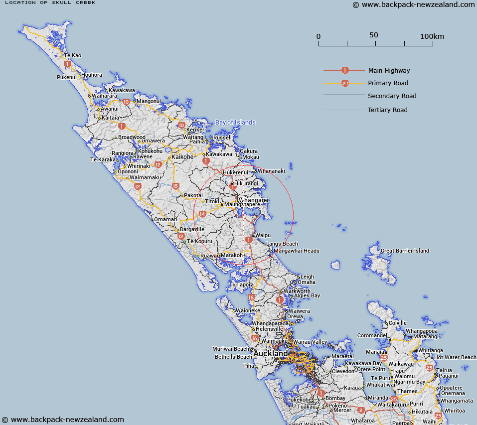
Skull Creek Map New Zealand


New Zealand places in our database
[ A ] [ B ] [ C ] [ D ] [ E ] [ F ] [ G ] [ H ] [ I ] [ J ] [ K ] [ L ] [ M ] [ N ] [ O ] [ P ] [ Q ] [ R ] [ S ] [ T ] [ U ] [ V ] [ W ] [ X ] [ Y ] [ Z ]


Closest 20 Streams to Skull Creek

Skull Creek ( 0km )   Mangapai River ( 2.33km )   Mata Creek ( 2.82km )   Takahiwai Stream ( 4.54km )   Tokitoki Creek ( 4.57km )   Waikokopa Stream ( 5.44km )   Ruakaka River ( 5.57km )   Ngako Creek ( 6.18km )   Tauroa Stream ( 6.52km )   Waikaurakaura Creek ( 6.87km )   Katetoke Creek ( 6.88km )   Paneiraira Creek ( 7.18km )   Waipapa Stream ( 7.19km )   Otaika Creek ( 8.08km )   Taihu Stream ( 8.96km )   Puwera Stream ( 9.43km )   Waiwarawara Stream ( 9.54km )   Waikaraka Stream ( 9.59km )   Te Waiiti Stream ( 9.84km )   Kohinui Stream ( 9.9km )   Waimahanga Stream ( 10.17km )   Limeburners Creek ( 10.37km )   H?tea River ( 10.78km )   Hatea River ( 10.78km )   Waiponamu Stream ( 11.03km )   Waitangata Stream ( 11.33km )   Rukuwai Stream ( 11.34km )   Waioneone Creek ( 11.6km )   Nihotetea Stream ( 12.04km )   Raumanga Stream ( 12.09km )   Awaroa Creek ( 12.16km )   Otakaranga Stream ( 12.29km )   Takatearea Stream ( 12.82km )   Otaika Stream ( 12.97km )   Taraunui Stream ( 13.09km )   Pohuenui River ( 13.37km )   Waikare Creek ( 13.59km )   Te Hihi Stream ( 14km )   North River ( 14km )   Taiharuru Stream ( 14.12km )