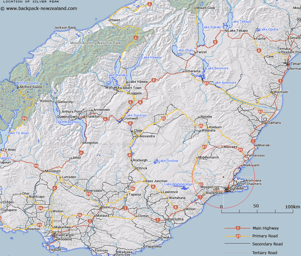
Map showing location of Silver Peak


LINZ description: 777m peak in The Silverpeaks. NZTopo50-CE17 014322
Latitude: -45.735445
Longitude: 170.446767
Northing: 4932175.1
Easting: 1401358.8
Land District: Otago
Feat Type: Hill


Scroll down to see a more detailed road map and below that a topographical map showing the location of Silver Peak. The road map has been supplied by openstreetmap and the topographical map of Silver Peak has been supplied by Land Information New Zealand (LINZ).

Yes you can use the top static map for you school/university project or personal website with a link back. Contact me for any commercial use.

Silver Peak Map New Zealand


New Zealand places in our database
[ A ] [ B ] [ C ] [ D ] [ E ] [ F ] [ G ] [ H ] [ I ] [ J ] [ K ] [ L ] [ M ] [ N ] [ O ] [ P ] [ Q ] [ R ] [ S ] [ T ] [ U ] [ V ] [ W ] [ X ] [ Y ] [ Z ]


Closest 20 Hills to Silver Peak

Pulpit Rock ( 1.2km )   Green Hill ( 2.12km )   Mount Allan ( 3.12km )   Mount John ( 3.68km )   Hightop ( 4.95km )   Clump Peak ( 5.56km )   Double Hill ( 6.47km )   Little Mount Allan ( 6.54km )   Mount Misery ( 6.72km )   Lamb Hill ( 6.75km )   Swampy Summit ( 6.98km )   Alexanders Hill ( 7.21km )   Powder Hill ( 8.23km )   Nicols Hill ( 8.53km )   Nicolls Hill ( 8.53km )   White Hill Cairn ( 8.62km )   Boulder Hill ( 9.05km )   Kilmog Hill ( 9.57km )   Pigeon Hill ( 10.83km )   Flagstaff ( 10.9km )   Wetherston Hill ( 10.98km )   Jones Hill ( 11.57km )   Porteous Hill ( 11.64km )   Ferny Hill ( 12.01km )   Mount Cargill ( 12.01km )   Whites Hill ( 12.27km )   Little Peak ( 12.3km )   Hammond Hill ( 12.32km )   Buttars Peak ( 12.36km )   Butters Peak ( 12.36km )   Mount Kettle ( 12.41km )   Mount Holmes ( 12.44km )   Mount Zion ( 12.71km )   Mount Cutten ( 12.87km )   Mount Martin ( 13.06km )   Mopanui ( 13.06km )   Mihiwaka ( 13.54km )   Mount Paul ( 13.61km )   Mount Hyde ( 13.78km )   Martins Hill ( 14.3km )