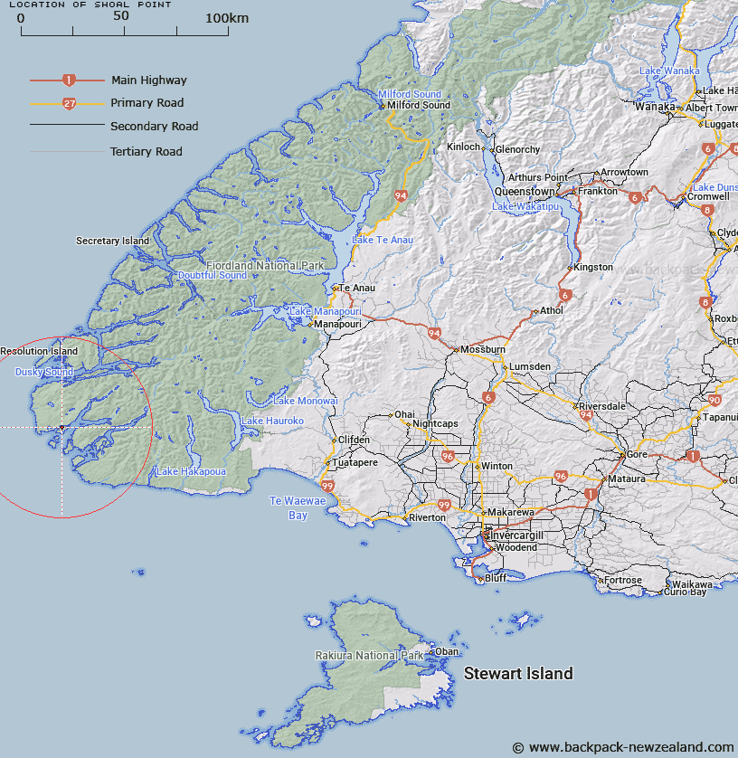
Map showing location of Shoal Point


LINZ description: Feature shown on: NZMS260 B45
Latitude: -45.980556
Longitude: 166.562444
Northing: 4887928
Easting: 1101386.9
Land District: Southland
Feat Type: Point


Scroll down to see a more detailed road map and below that a topographical map showing the location of Shoal Point. The road map has been supplied by openstreetmap and the topographical map of Shoal Point has been supplied by Land Information New Zealand (LINZ).

Yes you can use the top static map for you school/university project or personal website with a link back. Contact me for any commercial use.
Shoal Point Map New Zealand


New Zealand places in our database
[ A ] [ B ] [ C ] [ D ] [ E ] [ F ] [ G ] [ H ] [ I ] [ J ] [ K ] [ L ] [ M ] [ N ] [ O ] [ P ] [ Q ] [ R ] [ S ] [ T ] [ U ] [ V ] [ W ] [ X ] [ Y ] [ Z ]


Closest 20 Points to Shoal Point

Shoal Point ( 0km )   Mosquito Point ( 0.4km )   Breaker Point ( 3.54km )   Rocky Head ( 4.33km )   Surf Point ( 4.41km )   Surf Head ( 4.41km )   Stripe Head ( 4.85km )   Stripe Point ( 4.85km )   Cleft Point ( 5.72km )   Straggle Head ( 5.88km )   Reef Point ( 6.38km )   Drop Point ( 7.37km )   Divide Head ( 7.59km )   Cape Providence ( 7.83km )   Chalky Point ( 9.71km )   Red Head ( 10.15km )   Rounding Point ( 11.94km )   Gulches Head ( 12.52km )   Cavern Head ( 13.09km )   West Cape ( 13.43km )   Sandfly Point ( 13.95km )   Paddy Point ( 14.64km )   Lee Point ( 14.98km )   Colt Head ( 15.24km )   Two Cove Head ( 15.27km )   Moonlight Point ( 15.53km )   Adam Head ( 16.16km )   Trevaccoon Head ( 17.31km )   Trevacoon Head ( 17.31km )   Point Cameron ( 17.63km )   Observation Point ( 17.82km )   Sandy Point ( 17.95km )   Surf Point ( 18.89km )   Lower Coal Point ( 19.23km )   Puysegur Point ( 19.94km )   South Point ( 20.25km )   Astronomer Point ( 20.7km )   Wales Point ( 20.78km )   West Point ( 23.5km )   Windsor Point ( 24.42km )