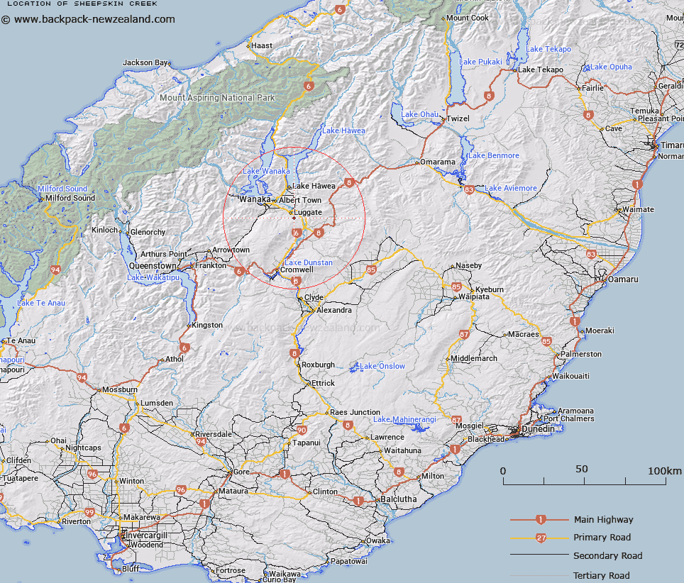
Map showing location of Sheepskin Creek


LINZ description: Flowing into Lake Wanaka from Trig. Station V. Between Boundary Creek and Waterfall Creek, 7km North of The Neck. Upper Wanaka Survey District.
Latitude: -44.770852
Longitude: 169.288354
Northing: 5035800
Easting: 1306300
Land District: Otago
Feat Type: Stream


Scroll down to see a more detailed road map and below that a topographical map showing the location of Sheepskin Creek. The road map has been supplied by openstreetmap and the topographical map of Sheepskin Creek has been supplied by Land Information New Zealand (LINZ).

Yes you can use the top static map for you school/university project or personal website with a link back. Contact me for any commercial use.

Sheepskin Creek Map New Zealand


New Zealand places in our database
[ A ] [ B ] [ C ] [ D ] [ E ] [ F ] [ G ] [ H ] [ I ] [ J ] [ K ] [ L ] [ M ] [ N ] [ O ] [ P ] [ Q ] [ R ] [ S ] [ T ] [ U ] [ V ] [ W ] [ X ] [ Y ] [ Z ]


Closest 20 Streams to Sheepskin Creek

Sheepskin Creek ( 0km )   Dead Horse Creek ( 2.32km )   Tin Hut Creek ( 2.74km )   Poison Creek ( 3.81km )   Trig Burn ( 5.22km )   Alfern Creek ( 5.29km )   Edward Burn ( 6.35km )   Crook Burn or 8 Mile Creek ( 7.28km )   Albert Burn ( 7.34km )   Luggate Creek ( 7.88km )   Schoolhouse Creek ( 9.16km )   Billy Creek ( 9.31km )   Alice Burn ( 9.89km )   Kidd Creek ( 10.4km )   Camp Creek ( 11.78km )   Basin Burn ( 11.79km )   Princess Burn ( 11.92km )   Lagoon Creek ( 11.99km )   Tarras Creek ( 12.42km )   H?wea River ( 12.67km )   Hawea River ( 12.67km )   Lochar Burn ( 13.18km )   Cliff Burn ( 13.84km )   Tinwald Burn or Wash Creek ( 13.97km )   Cardrona River ( 14.3km )   Archies Creek ( 14.32km )   Nine Mile Creek ( 14.34km )   Eight Mile Creek ( 15.85km )   Ram Valley Creek ( 16km )   Timber Creek ( 16.04km )   Drakes Creek ( 16.26km )   Deep Creek ( 16.64km )   Prince Burn ( 17.12km )   Grandview Creek ( 17.44km )   Lindis River ( 17.92km )   Waterfall Creek ( 18.08km )   Amisfield Burn ( 18.27km )   Spotts Creek ( 18.3km )   Coes Gully Creek Right Branch ( 18.56km )   Coes Gully Creek Left Branch ( 18.63km )