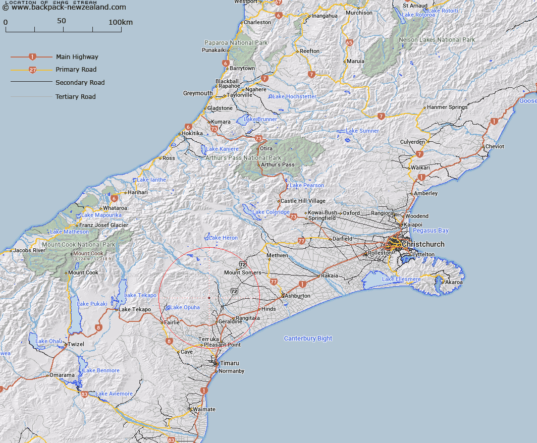
Map showing location of Shag Stream


LINZ description: Left bank tributary of Orari River, rising 3.5km West of Blandswood locality, flowing southward and joining Orari River 1.4km West of Trig. V (Geodetic Code AAF1). Block III Orari Survey District.
Latitude: -43.916972
Longitude: 171.19038
Northing: 5135757.1
Easting: 1454712.2
Land District: Canterbury
Feat Type: Stream


Scroll down to see a more detailed road map and below that a topographical map showing the location of Shag Stream. The road map has been supplied by openstreetmap and the topographical map of Shag Stream has been supplied by Land Information New Zealand (LINZ).

Yes you can use the top static map for you school/university project or personal website with a link back. Contact me for any commercial use.

Shag Stream Map New Zealand


New Zealand places in our database
[ A ] [ B ] [ C ] [ D ] [ E ] [ F ] [ G ] [ H ] [ I ] [ J ] [ K ] [ L ] [ M ] [ N ] [ O ] [ P ] [ Q ] [ R ] [ S ] [ T ] [ U ] [ V ] [ W ] [ X ] [ Y ] [ Z ]


Closest 20 Streams to Shag Stream

Emily Falls ( 3.23km )   Coopers Stream ( 3.44km )   Orari River ( 3.47km )   Rata Falls ( 3.99km )   Scotsburn Stream ( 4.22km )   Black Birch Stream ( 4.24km )   Kowhai Stream ( 4.5km )   Kowai Stream ( 4.5km )   Pickaxe Stream ( 4.52km )   Andrews Stream ( 4.56km )   Rata Stream ( 4.65km )   Selby Stream ( 4.66km )   Slip Panel Stream ( 4.67km )   Pinckney Stream ( 4.89km )   Moa Stream ( 5.69km )   Little Peel Stream ( 6.07km )   Mills Stream ( 6.49km )   Rocky Stream ( 6.76km )   Coopers Creek ( 6.81km )   Station Stream ( 6.91km )   Basin Stream ( 7.2km )   Lynn Stream ( 7.57km )   McLeod Stream ( 7.9km )   Moonlight Stream ( 7.93km )   Parson Stream ( 8.02km )   Howards Stream ( 8.24km )   Stony Stream ( 8.47km )   McNaughtons Stream ( 9.52km )   Deep Creek ( 10.61km )   Saddle Hut Stream ( 10.73km )   Mackintosh Stream ( 10.86km )   MacIntosh Stream ( 10.86km )   Chapmans Creek ( 11.06km )   Mount Peel Creek ( 11.24km )   Lochaber Stream ( 11.87km )   Bernard Stream ( 12.85km )   Middlestream ( 13.23km )   Hae Hae Te Moana River North Branch ( 13.8km )   Mathias Stream ( 14.02km )   Eyre Stream ( 14.16km )