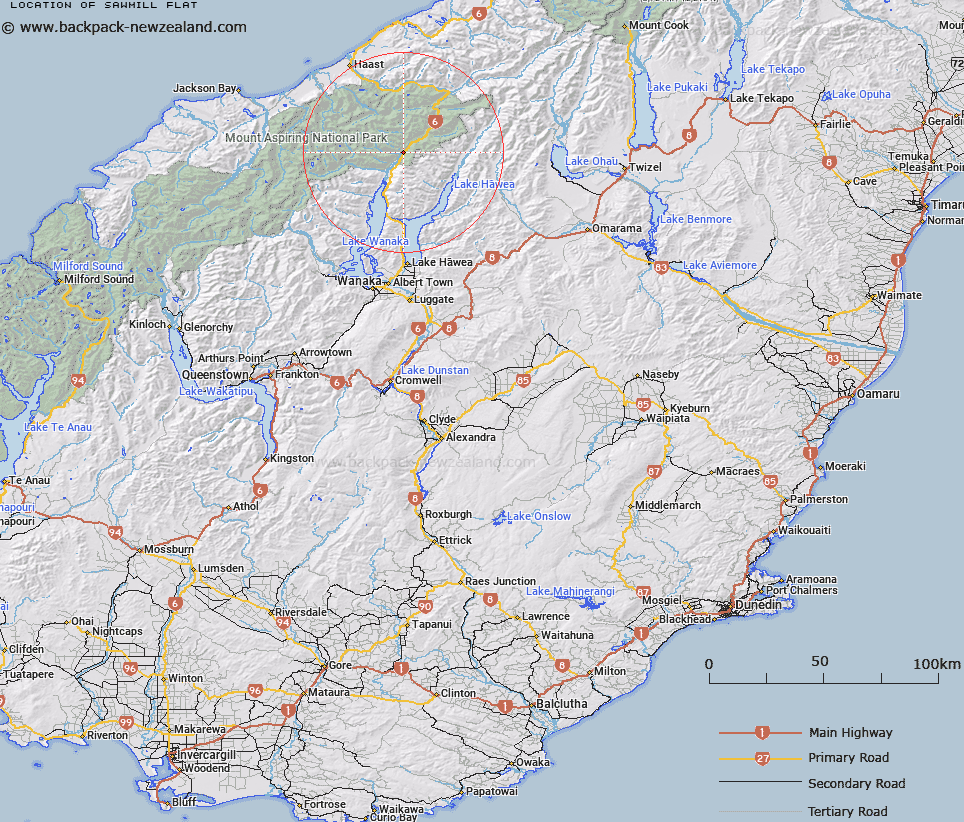
Map showing location of Sawmill Flat


LINZ description: On the Wanaka-Haast section of No.6 National State Highway half a mile south of Brady Creek. McKerrow Survey District.
Latitude: -44.20144
Longitude: 169.246747
Northing: 5098900
Easting: 1300100
Land District: Otago
Feat Type: Flat


Scroll down to see a more detailed road map and below that a topographical map showing the location of Sawmill Flat. The road map has been supplied by openstreetmap and the topographical map of Sawmill Flat has been supplied by Land Information New Zealand (LINZ).

Yes you can use the top static map for you school/university project or personal website with a link back. Contact me for any commercial use.

Sawmill Flat Map New Zealand


New Zealand places in our database
[ A ] [ B ] [ C ] [ D ] [ E ] [ F ] [ G ] [ H ] [ I ] [ J ] [ K ] [ L ] [ M ] [ N ] [ O ] [ P ] [ Q ] [ R ] [ S ] [ T ] [ U ] [ V ] [ W ] [ X ] [ Y ] [ Z ]


Closest 20 Flats to Sawmill Flat

Courtneys Flat ( 0.88km )   Boiler Flat ( 1.16km )   Millionaire Flat ( 2.02km )   Rainy Flat ( 2.74km )   Bridge Flat ( 2.94km )   Ram Flat ( 3.13km )   Cameron Flat ( 6.5km )   Kiwi Flat ( 8.89km )   Davis Flat ( 10.11km )   Dans Flat ( 13.57km )   Kerin Forks Flat ( 15.33km )   Blue Duck Flat ( 15.53km )   Burke Flat ( 22.37km )   Wonderland Flat ( 22.79km )   Pleasant Flat ( 24.21km )   Alpine Flat ( 24.5km )   Jumboland Flat ( 25.96km )   Quail Flat ( 27.21km )   Porridge Flat ( 27.77km )   Cron Flat ( 28.2km )   Sunny Flat ( 28.39km )   Mark Flat ( 28.83km )   Prospector Flat ( 28.97km )   Law Flat ( 30.16km )   Dinner Flat ( 30.31km )   Xmas Flat ( 30.42km )   Paddock Flat ( 30.84km )   Joes Flat ( 32.18km )   Waterfall Flat ( 32.6km )   Whakanui Flat ( 32.83km )   Caseys Flats ( 34.19km )   Forbes Flat ( 34.26km )   Axius Flats ( 35.67km )   Ruth Flat ( 35.91km )   Long Beach ( 35.99km )   Ferny Flat ( 36.84km )   Bonar Flats ( 37.22km )   Drake Flats ( 37.51km )   Harper Flat ( 38.67km )   Rabbit Flat ( 39.8km )