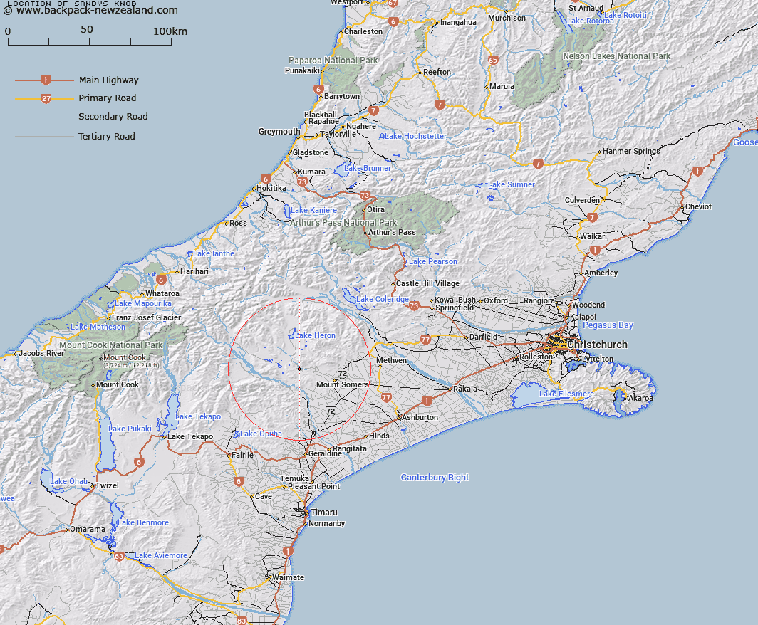
Map showing location of Sandys Knob


LINZ description: Hill feature in the Ashburton Gorge area. Rock wall rising out of Ashburton River. Trig S.
Latitude: -43.648539
Longitude: 171.213577
Northing: 5165611.5
Easting: 1455931.3
Land District: Canterbury
Feat Type: Hill


Scroll down to see a more detailed road map and below that a topographical map showing the location of Sandys Knob. The road map has been supplied by openstreetmap and the topographical map of Sandys Knob has been supplied by Land Information New Zealand (LINZ).

Yes you can use the top static map for you school/university project or personal website with a link back. Contact me for any commercial use.

Sandys Knob Map New Zealand


New Zealand places in our database
[ A ] [ B ] [ C ] [ D ] [ E ] [ F ] [ G ] [ H ] [ I ] [ J ] [ K ] [ L ] [ M ] [ N ] [ O ] [ P ] [ Q ] [ R ] [ S ] [ T ] [ U ] [ V ] [ W ] [ X ] [ Y ] [ Z ]


Closest 20 Hills to Sandys Knob

Mount Barrosa ( 3.37km )   Trinity Hill ( 3.91km )   Woolmer Hill ( 4.87km )   Mount Possession ( 5.19km )   Mount Tripp ( 5.37km )   Low Hills ( 9.63km )   Mount Pukanui ( 10.51km )   Cairn Hill ( 10.74km )   Dogs Hill ( 11.92km )   Mount Guy ( 12.17km )   Emily Hill ( 12.49km )   Mount Harper/Mahaanui ( 13.06km )   Mount Harper ( 13.06km )   Isolated Hill ( 13.31km )   Mount Somers ( 13.41km )   Staveley Hill ( 13.68km )   Fagan Hill ( 13.85km )   Cox Hills ( 14.03km )   The Brothers ( 14.18km )   The Fingers ( 15.28km )   Stevenson Hill ( 15.55km )   Pony Knob ( 15.56km )   Coal Hill ( 15.7km )   Hookey Knob ( 15.82km )   Mount Winterslow ( 16.28km )   Ouke Knob ( 16.4km )   Duke Knob ( 16.4km )   Mount Taylor ( 17.82km )   Lake Hill ( 18.44km )   Rawtor ( 18.58km )   Old Man Peak ( 19.48km )   Mount Sugarloaf ( 21.07km )   Harpers Knob ( 21.25km )   Red Mountain ( 21.43km )   Mount Alford ( 22.14km )   Mount Peel ( 22.48km )   Ben McLeod ( 23.13km )   Middle Mount Peel ( 23.67km )   Rock Pillar ( 23.83km )   Pyramid ( 24.01km )