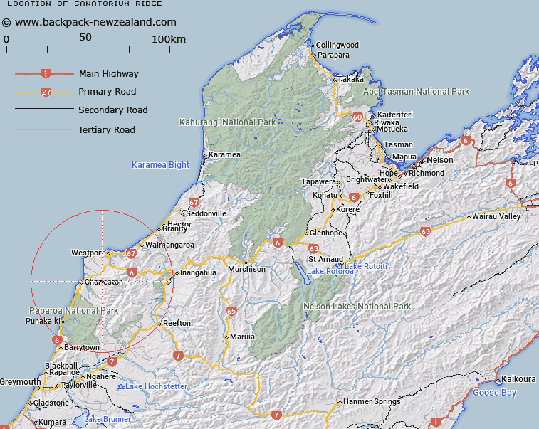
Map showing location of Sanatorium Ridge
LINZ description: Mountain ridge between the lower reaches of O'Keefe and Tailings Creeks which drain from the Paparoa Range, running South-eastward from the junction of Totara River and Tailings Creek for approximately 5km. Blocks IV and V Waitakere Survey District.
Latitude: -41.896884
Longitude: 171.548443
Northing: 5360653.8
Easting: 1479590.2
Land District: Nelson
Feat Type: Ridge
Latitude: -41.896884
Longitude: 171.548443
Northing: 5360653.8
Easting: 1479590.2
Land District: Nelson
Feat Type: Ridge

Scroll down to see a more detailed road map and below that a topographical map showing the location of Sanatorium Ridge. The road map has been supplied by openstreetmap and the topographical map of Sanatorium Ridge has been supplied by Land Information New Zealand (LINZ).
Yes you can use the top static map for you school/university project or personal website with a link back. Contact me for any commercial use.
[ A ] [ B ] [ C ] [ D ] [ E ] [ F ] [ G ] [ H ] [ I ] [ J ] [ K ] [ L ] [ M ] [ N ] [ O ] [ P ] [ Q ] [ R ] [ S ] [ T ] [ U ] [ V ] [ W ] [ X ] [ Y ] [ Z ]