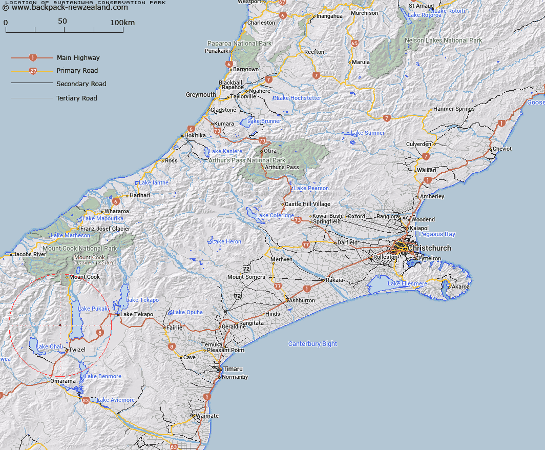
Map showing location of Ruataniwha Conservation Park


LINZ description: The Ruataniwha Conservation Park has over 36,800 hectares of rugged mountain country, tussock lands, beech/tawhai forest and sparkling clear rivers. The rolling Ben Ohau Range borders the eastern boundary of the park and it includes major valleys like the Dobson, Hopkins, Huxley, Temple and Maitland. Location: Ruataniwha Conservation Park is in the Mackenzie Basin, South Canterbury/Otago. The closest township is Twizel.
Latitude: -44.077996
Longitude: 170.048577
Northing: 5115228.2
Easting: 1363678.9
Land District: Canterbury
Feat Type: Conservation Park


Scroll down to see a more detailed road map and below that a topographical map showing the location of Ruataniwha Conservation Park. The road map has been supplied by openstreetmap and the topographical map of Ruataniwha Conservation Park has been supplied by Land Information New Zealand (LINZ).

Yes you can use the top static map for you school/university project or personal website with a link back. Contact me for any commercial use.

Ruataniwha Conservation Park Map New Zealand


New Zealand places in our database
[ A ] [ B ] [ C ] [ D ] [ E ] [ F ] [ G ] [ H ] [ I ] [ J ] [ K ] [ L ] [ M ] [ N ] [ O ] [ P ] [ Q ] [ R ] [ S ] [ T ] [ U ] [ V ] [ W ] [ X ] [ Y ] [ Z ]


Closest 20 Conservation Parks to Ruataniwha Conservation Park

Ahuriri Conservation Park ( 38.12km )   H?wea Conservation Park ( 55.46km )   Oteake Conservation Park ( 79.06km )   Hakatere Conservation Park ( 113.53km )   Craigieburn Forest Park ( 161.29km )   Korowai Torlesse Tussocklands Park ( 163.58km )   Te Papanui Conservation Park ( 182.14km )   Eyre Mountains/Taka Ra Haka Conservation Park ( 202.76km )   Lake Sumner Forest Park ( 238.83km )   Victoria Forest Park ( 267.57km )   Hanmer Conservation Park ( 278.05km )   Catlins Conservation Park ( 279.1km )   Ka Whata Tu O Rakihouia Conservation Park ( 350.63km )   Mt Richmond Forest Park ( 396.98km )   North-west Nelson Forest Park ( 415.55km )   Rimutaka Forest Park ( 514.16km )   Remutaka Forest Park ( 514.16km )   Aorangi Forest Park ( 519.52km )   Tararua Forest Park ( 567.85km )   Ng? Motu / Sugar Loaf Islands Conservation Park ( 649.19km )   Ruahine Forest Park ( 685.85km )   Kaimanawa Forest Park ( 743.13km )   Kaweka Forest Park ( 746.05km )   Pureora Forest Park ( 763.41km )   Pirongia Forest Park ( 796.01km )   Whirinaki Te Pua-a-T?ne Conservation Park ( 813.32km )   Whirinaki Conservation Park ( 813.32km )   Whakarewarewa Conservation Park ( 839.35km )   Kaimai Mamaku Conservation Park ( 860km )   Coromandel Forest Park ( 913.91km )   Raukumara Conservation Park ( 943.38km )   Tangihua Forest ( 976.22km )   Kaihu Forest ( 978.58km )   Houto Forest ( 982.15km )   Waipoua Forest ( 985.64km )   Marlborough Forest ( 986.34km )   Aotea Conservation Park ( 987.6km )   Mataraua Forest ( 993.33km )   Pukenui Forest ( 996.49km )   Waima Forest ( 996.5km )