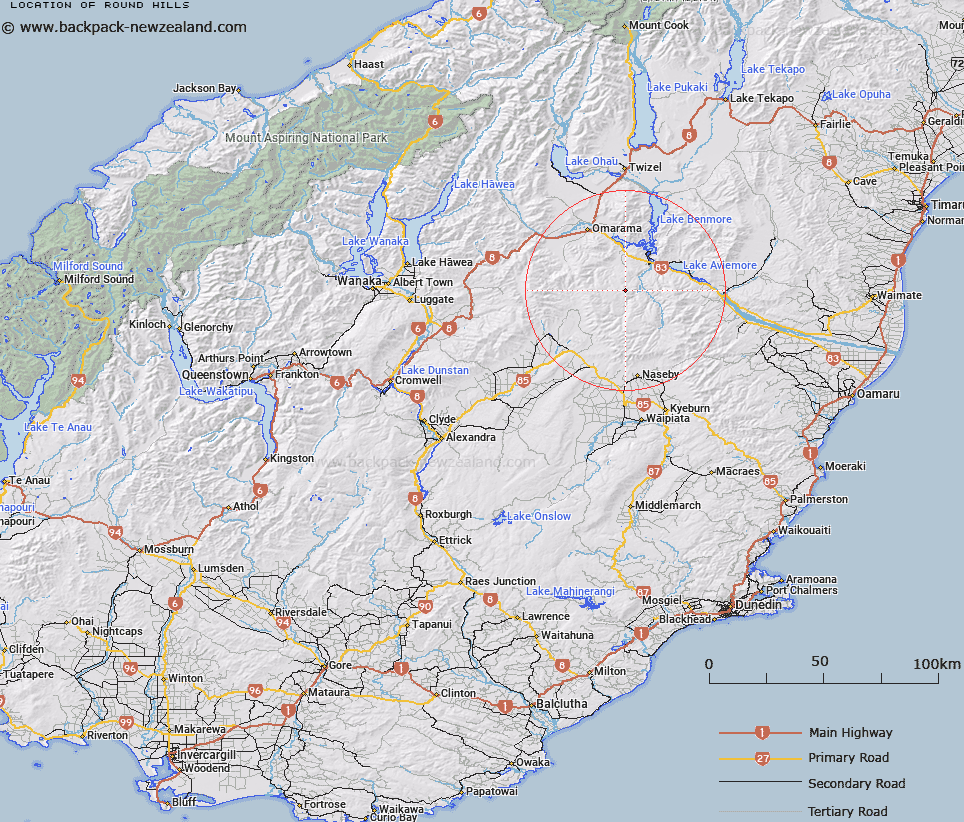
Map showing location of Round Hills


LINZ description: The hills extending north-westerly and south-easterly from Trig. Station L
Latitude: -44.708895
Longitude: 170.101686
Northing: 5045300
Easting: 1370413.7
Land District: Otago
Feat Type: Hill


Scroll down to see a more detailed road map and below that a topographical map showing the location of Round Hills. The road map has been supplied by openstreetmap and the topographical map of Round Hills has been supplied by Land Information New Zealand (LINZ).

Yes you can use the top static map for you school/university project or personal website with a link back. Contact me for any commercial use.

Round Hills Map New Zealand


New Zealand places in our database
[ A ] [ B ] [ C ] [ D ] [ E ] [ F ] [ G ] [ H ] [ I ] [ J ] [ K ] [ L ] [ M ] [ N ] [ O ] [ P ] [ Q ] [ R ] [ S ] [ T ] [ U ] [ V ] [ W ] [ X ] [ Y ] [ Z ]


Closest 20 Hills to Round Hills

Mount Weta ( 10.4km )   Mount Horrible ( 14.22km )   Pass Peak ( 15.11km )   Baldy Knob ( 15.6km )   Mount Bitterness ( 16.7km )   Mount Saint Cuthbert ( 19.84km )   Mount Kohurau ( 20.6km )   Maori Hummock ( 20.76km )   Tunnel Hill ( 21.56km )   Sugar Loaf ( 21.8km )   Home Hill ( 24.23km )   Home Hills ( 24.23km )   Ida Mountain ( 24.68km )   Totara Peak ( 25.35km )   Mount Dryburgh ( 26.4km )   Mount Buster ( 26.65km )   Mount Saint Bathans ( 26.93km )   Kurow Hill/Te Kohurau ( 27.09km )   Kurow Hill ( 27.09km )   Mount Domet ( 27.51km )   Mount Domett ( 27.51km )   Big Ben ( 27.63km )   Little Mount Ida ( 27.74km )   Grayson Peak ( 27.86km )   Little Domett ( 28.19km )   Pennyweight Hill ( 28.88km )   Mount Kyeburn ( 29.18km )   Potato Pit Hill ( 30.41km )   Cone ( 30.57km )   Diggings Peak ( 31.21km )   Seagull Hill ( 31.65km )   Benmore Peak ( 32.44km )   Quartz Reef Hill ( 32.76km )   Mount David ( 33.28km )   Woodney Hill ( 33.46km )   Dunstan Peak ( 33.59km )   Cloud Hill ( 33.65km )   Mount Sutton ( 34.3km )   The Buscot ( 34.4km )   Sutherlands Peak ( 34.57km )