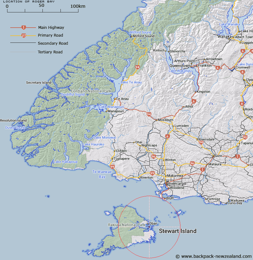
Map showing location of Roger Bay


LINZ description: Bay on South coast of East End of Ulva Island, Paterson Inlet, Stewart Island. 600m West of eastern headland. Paterson Survey District.
Latitude: -46.936279
Longitude: 168.148281
Northing: 4790481.2
Easting: 1230736.6
Land District: Southland
Feat Type: Bay


Scroll down to see a more detailed road map and below that a topographical map showing the location of Roger Bay. The road map has been supplied by openstreetmap and the topographical map of Roger Bay has been supplied by Land Information New Zealand (LINZ).

Yes you can use the top static map for you school/university project or personal website with a link back. Contact me for any commercial use.

Roger Bay Map New Zealand


New Zealand places in our database
[ A ] [ B ] [ C ] [ D ] [ E ] [ F ] [ G ] [ H ] [ I ] [ J ] [ K ] [ L ] [ M ] [ N ] [ O ] [ P ] [ Q ] [ R ] [ S ] [ T ] [ U ] [ V ] [ W ] [ X ] [ Y ] [ Z ]


Closest 20 Bays to Roger Bay

The Snuggery ( 0.66km )   Sydney Cove ( 1.21km )   Papatiki Bay ( 1.63km )   Carter Bay ( 1.63km )   Manning Bay ( 1.78km )   Jacky Lee Bay ( 1.8km )   Pinch Gut ( 2.18km )   Eastern Bay ( 2.26km )   Cooper Bay ( 2.79km )   Coupar Bay ( 2.79km )   Traills Bay ( 2.93km )   Gentian Cove ( 2.98km )   Deep Bay ( 3.31km )   Joss Bay ( 3.36km )   Back Bay ( 3.42km )   Karimoni Beach ( 3.42km )   Buller Bay ( 3.77km )   Sailors Rest ( 3.86km )   Evening Cove ( 3.98km )   Whale Corner ( 3.98km )   Glory Cove ( 4km )   Golden Bay ( 4.1km )   Goose Cove ( 4.13km )   Little Bay ( 4.2km )   Thule Bay ( 4.22km )   Leask Bay ( 4.25km )   Thomson Bay ( 4.45km )   Jensen Bay ( 4.46km )   Harrold Bay ( 4.52km )   Vaila Voe Bay ( 4.58km )   Avelavo Bay ( 4.58km )   Jack The Rippers Bay ( 4.58km )   Big Glory Bay ( 4.95km )   Halfmoon Bay ( 5.07km )   Sarah Cove ( 5.25km )   Bragg Bay ( 5.34km )   Hapuatuna Bay ( 5.87km )   Torias Corner ( 6.25km )   Fuschia Bay ( 6.55km )   Paterson Inlet/Whaka a Te Wera ( 6.66km )