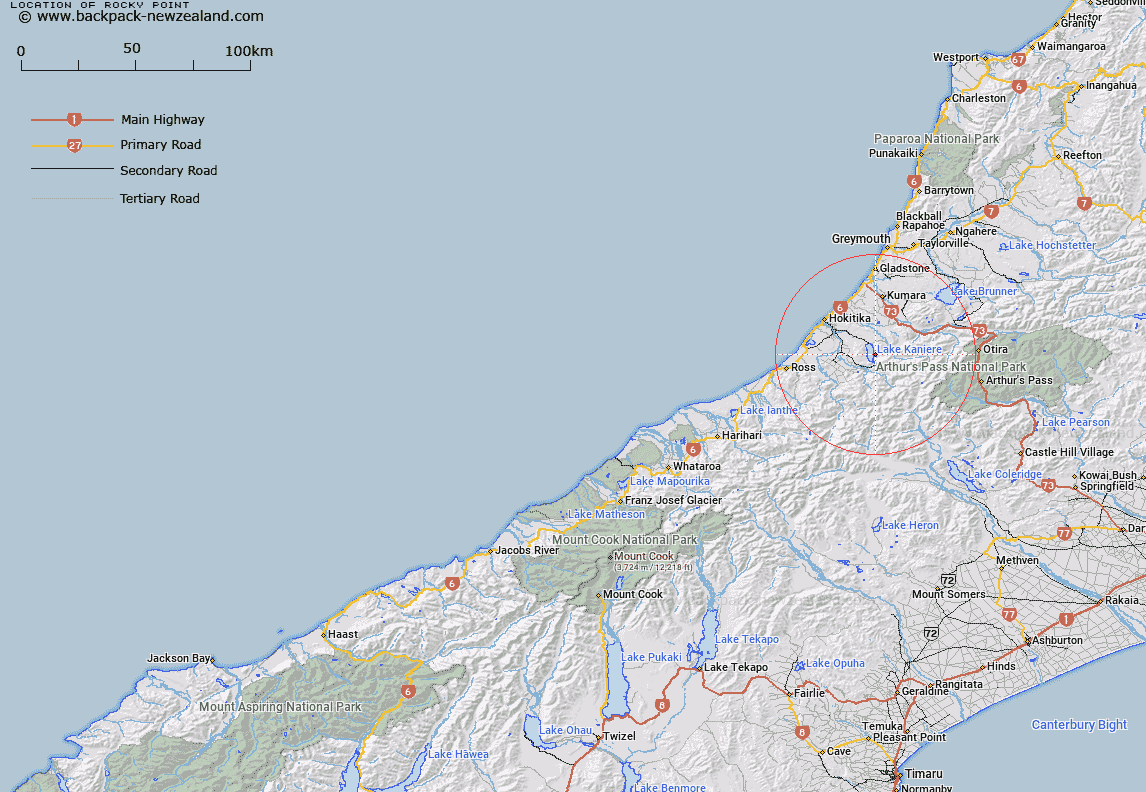
Map showing location of Rocky Point


LINZ description: Feature shown on: NZMS260-J33 596164; NZTopo50-BV19 496547;
Latitude: -42.84549
Longitude: 171.15942
Northing: 5254700
Easting: 1449600
Land District: Westland
Feat Type: Point


Scroll down to see a more detailed road map and below that a topographical map showing the location of Rocky Point. The road map has been supplied by openstreetmap and the topographical map of Rocky Point has been supplied by Land Information New Zealand (LINZ).

Yes you can use the top static map for you school/university project or personal website with a link back. Contact me for any commercial use.

Rocky Point Map New Zealand


New Zealand places in our database
[ A ] [ B ] [ C ] [ D ] [ E ] [ F ] [ G ] [ H ] [ I ] [ J ] [ K ] [ L ] [ M ] [ N ] [ O ] [ P ] [ Q ] [ R ] [ S ] [ T ] [ U ] [ V ] [ W ] [ X ] [ Y ] [ Z ]


Closest 20 Points to Rocky Point

Rocky Point ( 0km )   Rocky Point/Tauotikirangi ( 0km )   Picnic Point ( 19.51km )   Hobart Point ( 20.86km )   Knoll Point ( 31.05km )   Camp Point ( 31.14km )   Drake Point ( 31.9km )   Hohonu Spit ( 33.59km )   Stormy Point ( 35.45km )   Pah Point ( 35.89km )   Blacksmith Point ( 36.66km )   Howitt Point ( 36.78km )   Totara Point ( 48.98km )   Point Elizabeth ( 52.06km )   Wanganui Heads ( 64.61km )   Blue Point ( 69.16km )   Snapper Point ( 69.84km )   Woodcutters Point ( 70.94km )   Beachy Point ( 73.78km )   Cookies Point ( 76.55km )   Abut Head ( 78.55km )   Razorback Point ( 81.38km )   Dolomite Point ( 82.48km )   Commissioner Point ( 83.64km )   Stoney Point ( 83.65km )   Charleys Point ( 85.77km )   Perpendicular Point ( 85.98km )   Burrough Head ( 86.49km )   Cape Josephine ( 87.08km )   Canoe Point ( 87.91km )   Cape Buttercup ( 88.2km )   Blowing Point ( 88.28km )   Motukutuka Point ( 88.91km )   Maungahura Point ( 90.21km )   Rehder Head ( 90.54km )   Kaipakati Point ( 91.4km )   Bloody Point ( 92.7km )   Fossil Point ( 92.97km )   Needle Point ( 101.59km )   Galway Point ( 119.28km )