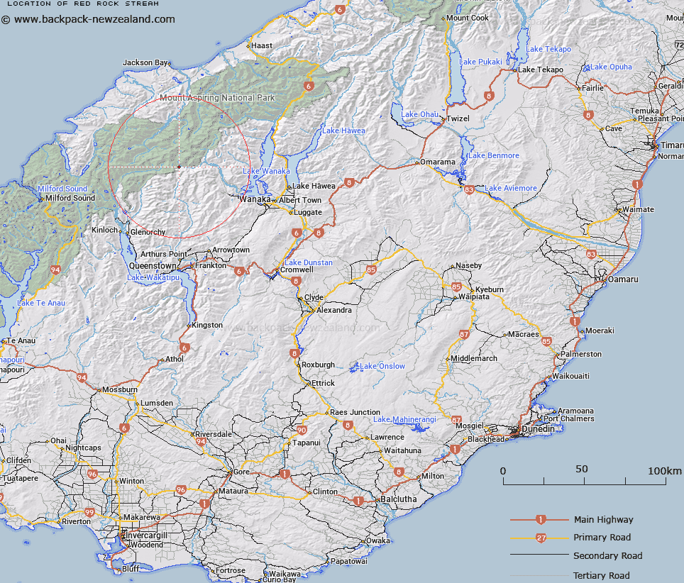
Map showing location of Red Rock Stream


LINZ description: Stream flowing north-easterly from source on the North-eastern slopes of Mount Tyndall, joining the western branch of Matukituki River 3.1km North of Red Rock Peak. Cascade Survey District.
Latitude: -44.505039
Longitude: 168.668728
Northing: 5062900
Easting: 1255697.3
Land District: Otago
Feat Type: Stream


Scroll down to see a more detailed road map and below that a topographical map showing the location of Red Rock Stream. The road map has been supplied by openstreetmap and the topographical map of Red Rock Stream has been supplied by Land Information New Zealand (LINZ).

Yes you can use the top static map for you school/university project or personal website with a link back. Contact me for any commercial use.

Red Rock Stream Map New Zealand


New Zealand places in our database
[ A ] [ B ] [ C ] [ D ] [ E ] [ F ] [ G ] [ H ] [ I ] [ J ] [ K ] [ L ] [ M ] [ N ] [ O ] [ P ] [ Q ] [ R ] [ S ] [ T ] [ U ] [ V ] [ W ] [ X ] [ Y ] [ Z ]


Closest 20 Streams to Red Rock Stream

Brides Veil Stream ( 1.59km )   Matukituki River West Branch ( 2.5km )   Wilsons Camp Stream ( 2.93km )   Cascade Creek ( 3.66km )   Tyndall Stream ( 4.09km )   Rob Roy Creek ( 4.16km )   Downs Creek ( 4.59km )   Rob Roy Stream ( 4.98km )   Rough Creek ( 5.1km )   Tummel Burn ( 5.51km )   Big Creek ( 5.51km )   Tyndall Creek ( 5.62km )   Rasberry Creek ( 6.91km )   MacPherson Creek ( 8.23km )   Liverpool Stream ( 8.27km )   Pine Creek ( 8.53km )   Wishbone Creek ( 8.58km )   Snowy Creek ( 9.24km )   Sheepyard Creek ( 9.4km )   Polnoon Burn (Middle Branch) ( 9.53km )   Homestead Creek ( 10.35km )   Dry Rock Creek ( 10.93km )   Whitbourn River ( 11.22km )   Glacier Burn ( 11.69km )   Glenfinnan Stream ( 11.99km )   Lake Creek ( 12.42km )   Polnoon Burn (East Branch) ( 12.7km )   Niger Stream ( 12.98km )   Blue Duck River ( 13.5km )   The Wilson ( 13.7km )   The Bignell ( 13.88km )   Rough Creek ( 14.08km )   Spurling Creek ( 14.12km )   Mill Creek or Corner Burn ( 14.14km )   Cabin Pass Rapids ( 14.15km )   Glencairn Creek ( 14.17km )   Phantom Creek ( 14.32km )   The Bascand ( 14.35km )   Snowball Creek ( 14.78km )   Stokes Creek ( 15.07km )