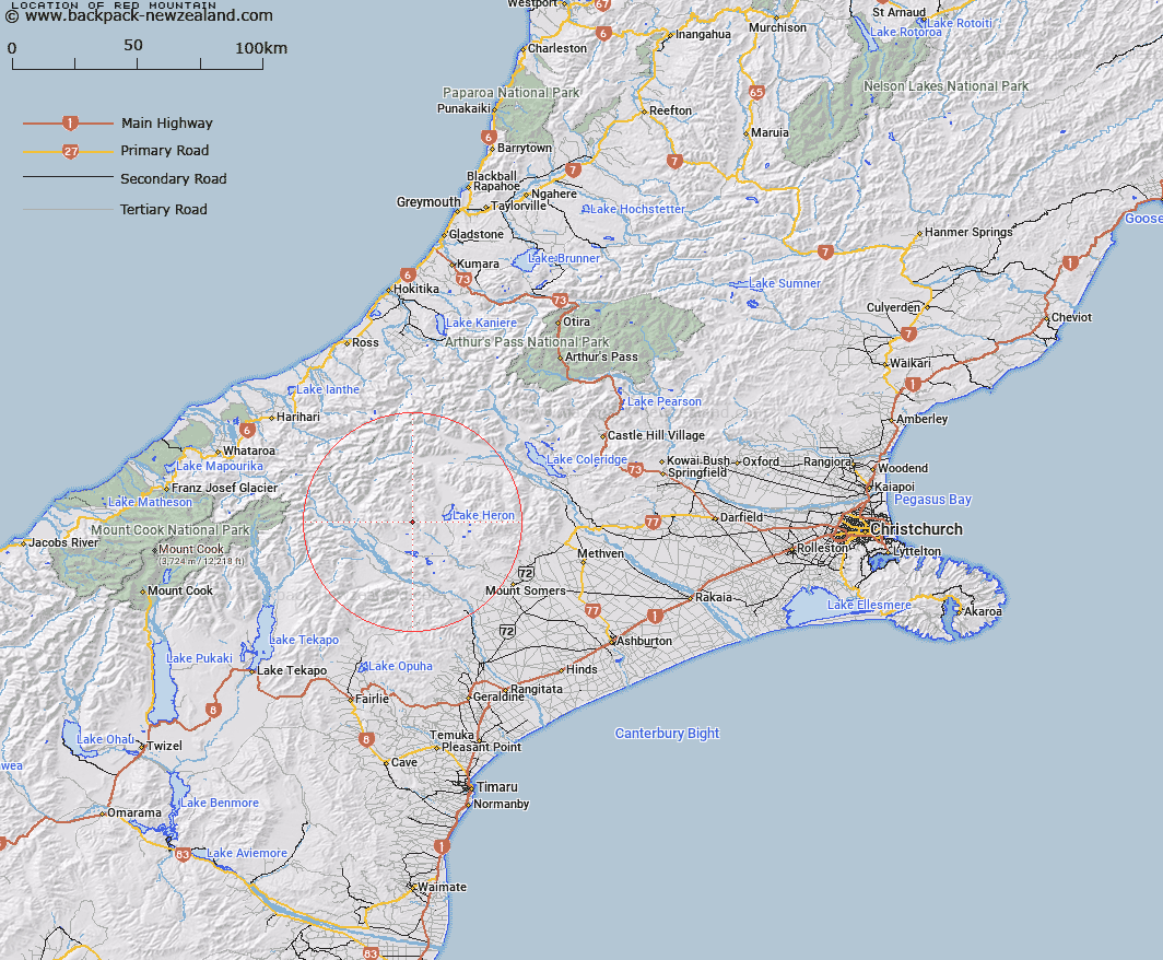
Map showing location of Red Mountain


LINZ description: Peak between Big Hell Range and Ashburton River opposite Lake Heron, about 2 1/2 miles south of Gordon Gully.
Latitude: -43.498081
Longitude: 171.047412
Northing: 5182019.9
Easting: 1442137.7
Land District: Canterbury
Feat Type: Hill


Scroll down to see a more detailed road map and below that a topographical map showing the location of Red Mountain. The road map has been supplied by openstreetmap and the topographical map of Red Mountain has been supplied by Land Information New Zealand (LINZ).

Yes you can use the top static map for you school/university project or personal website with a link back. Contact me for any commercial use.

Red Mountain Map New Zealand


New Zealand places in our database
[ A ] [ B ] [ C ] [ D ] [ E ] [ F ] [ G ] [ H ] [ I ] [ J ] [ K ] [ L ] [ M ] [ N ] [ O ] [ P ] [ Q ] [ R ] [ S ] [ T ] [ U ] [ V ] [ W ] [ X ] [ Y ] [ Z ]


Closest 20 Hills to Red Mountain

Pyramid ( 6.63km )   Wild Mans Hill ( 9.02km )   The Pyramid ( 9.39km )   Dogs Hill ( 9.66km )   Mount Potts ( 9.91km )   Mount Guy ( 10.86km )   Staces Hill ( 11.02km )   Lake Hill ( 11.44km )   Harpers Knob ( 11.83km )   Isolated Hill ( 12.27km )   Middle Hill ( 12.3km )   Mount Sugarloaf ( 12.98km )   Pito Peak ( 13.13km )   Mount Sunday ( 13.62km )   Mount Caroline ( 13.81km )   South Peak ( 14.49km )   Teddys Hill ( 15.24km )   Hakatere Peak ( 15.28km )   Ashburton Peak ( 15.8km )   East Horn Peak ( 16.04km )   Emily Hill ( 16.33km )   Shaggy Hill ( 16.61km )   Mount Arrowsmith ( 16.64km )   The Marquee ( 17.1km )   Tent Peak ( 17.46km )   Trinity Hill ( 17.62km )   Mount Harper ( 17.79km )   Mount Harper/Mahaanui ( 17.79km )   Mount McRae ( 17.8km )   The Twins ( 17.94km )   Couloir Peak ( 18.04km )   Cascade Hill ( 18.19km )   Prop Peak ( 18.29km )   Mount Jollie ( 18.39km )   Tower Peak ( 18.49km )   Upham Peak ( 18.52km )   Jagged Peak ( 18.56km )   Mount Catherine ( 19.3km )   Lawrence Peak ( 19.38km )   Mount Possession ( 19.71km )