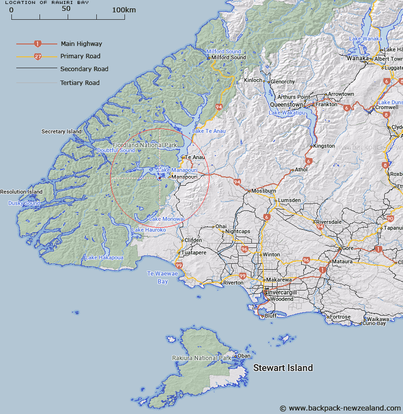
Map showing location of Rawiri Bay


LINZ description: Bay in the Hope Arm of Lake Manapouri.
Latitude: -45.56735
Longitude: 167.53937
Northing: 4939500
Easting: 1173900
Land District: Southland
Feat Type: Bay


Scroll down to see a more detailed road map and below that a topographical map showing the location of Rawiri Bay. The road map has been supplied by openstreetmap and the topographical map of Rawiri Bay has been supplied by Land Information New Zealand (LINZ).

Yes you can use the top static map for you school/university project or personal website with a link back. Contact me for any commercial use.

Rawiri Bay Map New Zealand


New Zealand places in our database
[ A ] [ B ] [ C ] [ D ] [ E ] [ F ] [ G ] [ H ] [ I ] [ J ] [ K ] [ L ] [ M ] [ N ] [ O ] [ P ] [ Q ] [ R ] [ S ] [ T ] [ U ] [ V ] [ W ] [ X ] [ Y ] [ Z ]


Closest 20 Bays to Rawiri Bay

George Bay ( 1.12km )   Hope Arm ( 1.73km )   Surprise Bay ( 2.37km )   Circle Cove ( 3.23km )   Stockyard Cove ( 4.2km )   Pearl Harbour ( 5.65km )   South Port ( 6km )   Supply Bay ( 6.75km )   Shallow Bay ( 9.89km )   Calm Bay ( 10.1km )   South Arm ( 10.47km )   West Mere ( 11.16km )   Queens Reach ( 15.04km )   North Arm ( 17.22km )   Safe Cove ( 17.97km )   West Arm ( 18.15km )   Dock Bay ( 18.55km )   Brod Bay ( 21.39km )   Garnet Bay ( 24km )   South Fiord ( 24.77km )   East Cove ( 25.16km )   Driftwood Cove ( 25.43km )   Patience Bay ( 25.56km )   Mussel Cove ( 25.76km )   Fowlers Arm ( 27.64km )   Hincheys Outlet ( 27.86km )   Dinghy Cove ( 28.89km )   Shallow Bay ( 29.74km )   Helena Anchorage ( 31.36km )   Wanganella Cove ( 32.21km )   Rodger Inlet ( 32.25km )   Boat Harbour ( 33.31km )   Deep Cove ( 33.78km )   Olphert Cove ( 35.88km )   Hall Arm ( 37.03km )   June Bay ( 37.11km )   Shoal Cove ( 39.35km )   Shelter Cove ( 40.31km )   Pleasant Bay ( 43.59km )   Te Poupouotu ( 44.26km )