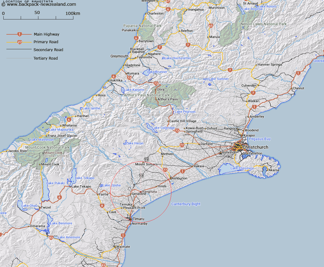
Map showing location of Rangitata


LINZ description: Locality on the South bank of the Rangitata River, 35km South-west of Ashburton, and 21km North of Temuka. Geraldine Survey District.
Latitude: -44.065918
Longitude: 171.373111
Northing: 5119519
Easting: 1469709.5
Land District: Canterbury
Feat Type: Town


Scroll down to see a more detailed road map and below that a topographical map showing the location of Rangitata. The road map has been supplied by openstreetmap and the topographical map of Rangitata has been supplied by Land Information New Zealand (LINZ).

Yes you can use the top static map for you school/university project or personal website with a link back. Contact me for any commercial use.

Rangitata Map New Zealand


New Zealand places in our database
[ A ] [ B ] [ C ] [ D ] [ E ] [ F ] [ G ] [ H ] [ I ] [ J ] [ K ] [ L ] [ M ] [ N ] [ O ] [ P ] [ Q ] [ R ] [ S ] [ T ] [ U ] [ V ] [ W ] [ X ] [ Y ] [ Z ]


Closest 20 Towns to Rangitata

Borrell Creek Cutting ( 23.9km )   Butlers Crossing ( 27.09km )   Stratheona Huts ( 27.96km )   Tinwald ( 32.22km )   Ashburton ( 34.68km )   Timaru ( 38.15km )   South Rakaia ( 62.59km )   Rakaia ( 62.59km )   Fereday Island ( 69.02km )   The Island ( 74.47km )   Waimate ( 78.55km )   Tekapo Military Camp ( 78.55km )   Freezing Point ( 79.87km )   Sibbalds Island ( 82.31km )   Rabbit Island ( 88.28km )   Hydra Island ( 88.68km )   Slip Panels Corner ( 89.23km )   The Redoubt ( 98.73km )   The Buttress ( 102.63km )   The Gateway ( 102.93km )   Twizel ( 104km )   The Cove ( 106.03km )   Hooker Corner ( 106.18km )   Tarnmoor ( 108.46km )   Aoraki/Mount Cook ( 108.57km )   Mount Cook ( 108.57km )   The Attic ( 110.06km )   Otematata ( 111.39km )   Ashbys Pit ( 115.16km )   Sailors Cutting ( 115.8km )   Birch Nook ( 117.38km )   Christchurch ( 117.54km )   Roberts Point ( 118.13km )   Klondyke Corner ( 118.68km )   Oamaru ( 119km )   Lyttelton ( 119.65km )   The Groynes ( 119.96km )   Wataroa ( 120.61km )   Whataroa ( 120.61km )   Lake Ohau Alpine Village ( 123.85km )