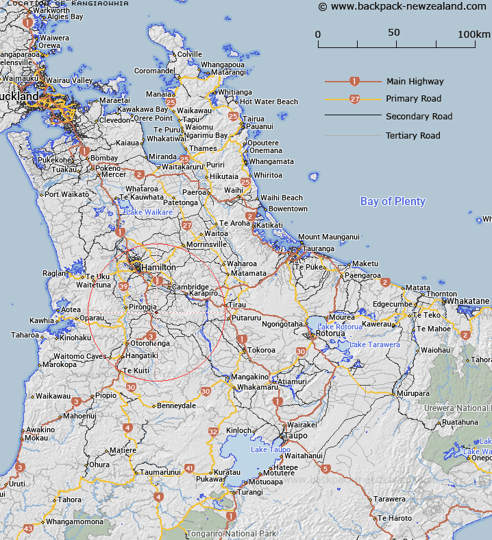
Map showing location of Rangiaowhia
LINZ description: Small locality 5km east of Te Awamutu
Latitude: -38.018084
Longitude: 175.377036
Northing: 5789511.8
Easting: 1808660.7
Land District: South Auckland
Feat Type: Locality
Latitude: -38.018084
Longitude: 175.377036
Northing: 5789511.8
Easting: 1808660.7
Land District: South Auckland
Feat Type: Locality

Scroll down to see a more detailed road map and below that a topographical map showing the location of Rangiaowhia. The road map has been supplied by openstreetmap and the topographical map of Rangiaowhia has been supplied by Land Information New Zealand (LINZ).
Yes you can use the top static map for you school/university project or personal website with a link back. Contact me for any commercial use.
[ A ] [ B ] [ C ] [ D ] [ E ] [ F ] [ G ] [ H ] [ I ] [ J ] [ K ] [ L ] [ M ] [ N ] [ O ] [ P ] [ Q ] [ R ] [ S ] [ T ] [ U ] [ V ] [ W ] [ X ] [ Y ] [ Z ]