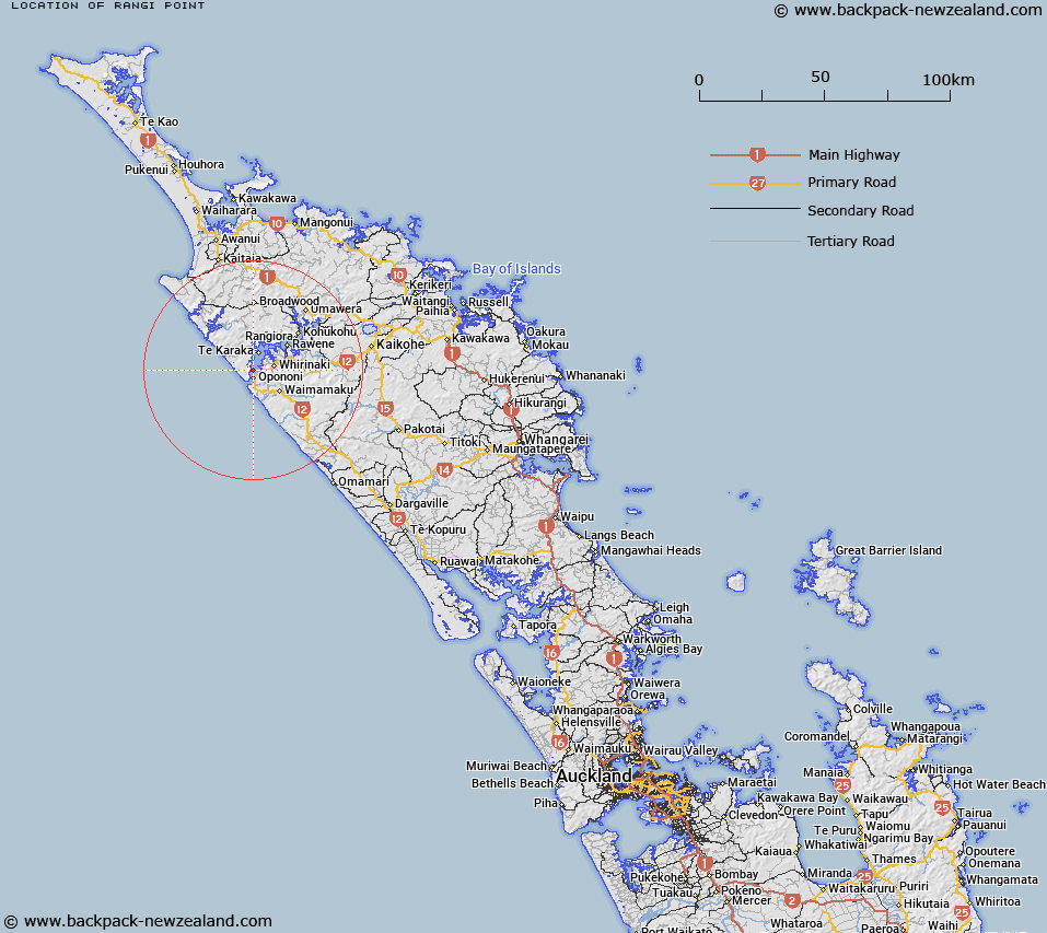
Map showing location of Rangi Point


LINZ description: A coastal point on the western shores of Hokianga Harbour approximately 5km from the harbour entrance. NZTopo50-AW26 350729.
Latitude: -35.486059
Longitude: 173.386402
Northing: 6072984.1
Easting: 1635050.2
Land District: North Auckland
Feat Type: Point


Scroll down to see a more detailed road map and below that a topographical map showing the location of Rangi Point. The road map has been supplied by openstreetmap and the topographical map of Rangi Point has been supplied by Land Information New Zealand (LINZ).

Yes you can use the top static map for you school/university project or personal website with a link back. Contact me for any commercial use.

Rangi Point Map New Zealand


New Zealand places in our database
[ A ] [ B ] [ C ] [ D ] [ E ] [ F ] [ G ] [ H ] [ I ] [ J ] [ K ] [ L ] [ M ] [ N ] [ O ] [ P ] [ Q ] [ R ] [ S ] [ T ] [ U ] [ V ] [ W ] [ X ] [ Y ] [ Z ]


Closest 20 Points to Rangi Point

Koutu Point ( 1.67km )   Taumatakanae Point ( 1.92km )   Rangi Point ( 2.89km )   Kawehetiki Point ( 2.89km )   Te Mata Point ( 4.23km )   North Head ( 4.41km )   Kauwhare Point ( 4.41km )   Te Rewa Point ( 4.93km )   South Head ( 5.56km )   Outer South Head ( 7.17km )   Matawhera Point ( 12.86km )   Motukaraka Point ( 14.41km )   Moerewa Point ( 15.61km )   Tuapeke Point ( 19.04km )   Te Umakuri Point ( 23.83km )   Koekoe Point ( 24.29km )   Marmons Point ( 25.09km )   Tauroa Point ( 45.86km )   Reef Point ( 45.86km )   Tauroa Point (Reef Point) ( 46.41km )   Long Point ( 53.84km )   Taupuke Point ( 55.25km )   Fergusson Point ( 56.09km )   Ferguson Point ( 56.09km )   Prices Point ( 56.19km )   White Point ( 56.86km )   Kauri Point ( 57.07km )   Butler Point ( 57.19km )   Cape Horn ( 57.33km )   Goldfinch Point ( 57.37km )   Oyster Point ( 57.54km )   Cole Point ( 57.61km )   Rangikapiti Head ( 57.61km )   Rangitoto Point ( 57.87km )   Osprey Head ( 58.07km )   Kaheka Point ( 59.86km )   Oteko Point ( 60.46km )   Puketamoi Point ( 60.76km )   Waihi Point ( 61.06km )   Jones Point ( 61.38km )