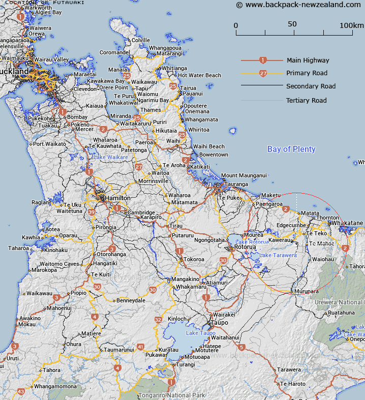
Map showing location of Putauaki


LINZ description: Mountain located 2.5km south-east of Lake Pupuwharau, near Town Kawerau
Latitude: -38.107158
Longitude: 176.739539
Northing: 5775686.5
Easting: 1927899.1
Land District: South Auckland
Feat Type: Hill


Scroll down to see a more detailed road map and below that a topographical map showing the location of Putauaki. The road map has been supplied by openstreetmap and the topographical map of Putauaki has been supplied by Land Information New Zealand (LINZ).

Yes you can use the top static map for you school/university project or personal website with a link back. Contact me for any commercial use.

Putauaki Map New Zealand


New Zealand places in our database
[ A ] [ B ] [ C ] [ D ] [ E ] [ F ] [ G ] [ H ] [ I ] [ J ] [ K ] [ L ] [ M ] [ N ] [ O ] [ P ] [ Q ] [ R ] [ S ] [ T ] [ U ] [ V ] [ W ] [ X ] [ Y ] [ Z ]


Closest 20 Hills to Putauaki

Onepu ( 5.21km )   Putaorangitawa ( 7.12km )   Te Arohou ( 8.54km )   Tokotokorau ( 10.22km )   Koheroa ( 12.77km )   Oteranginui ( 13.11km )   Taumatamiere ( 13.25km )   Hiwera ( 13.29km )   Maungawhakamana ( 13.74km )   Ngamotu ( 14.01km )   Okahanga ( 14.08km )   Puhipuhi ( 14.28km )   Otuhepo ( 15.75km )   Te Monehu ( 15.8km )   Manawahe ( 17.19km )   Pukehinau ( 18.47km )   Te Tawa ( 19.06km )   Pukehou ( 19.28km )   Motupiko ( 19.47km )   Kaipunapuna ( 19.94km )   Te Tawa ( 20.39km )   Haroharo ( 20.42km )   Waikakareao ( 20.74km )   Poroa ( 20.82km )   Matikara ( 22.19km )   Nohonoho ( 22.62km )   Wahanga Peak ( 22.78km )   Wahanga Dome ( 22.78km )   Papanui ( 22.85km )   Whakarimarima ( 22.86km )   Ridge Dome ( 22.92km )   Tiritiri ( 22.96km )   Te Kanakana Dome ( 23.25km )   Kanakana ( 23.33km )   Te Whakaumu ( 23.33km )   Te Ngaere ( 23.58km )   Pukerimu ( 23.98km )   Ruawahia Peak ( 24.36km )   Ruawahia Dome ( 24.36km )   Makatiti Dome ( 24.37km )