Map showing location of Puku-o-Kongahu


LINZ description: Feature shown on: NZMS260 L28; NZTopo50-BQ21 152113
Latitude: -41.445074
Longitude: 171.98567
Northing: 5411337.2
Easting: 1515269.1
Land District: Nelson
Feat Type: Point


Scroll down to see a more detailed road map and below that a topographical map showing the location of Puku-o-Kongahu. The road map has been supplied by openstreetmap and the topographical map of Puku-o-Kongahu has been supplied by Land Information New Zealand (LINZ).

Yes you can use the top static map for you school/university project or personal website with a link back. Contact me for any commercial use.
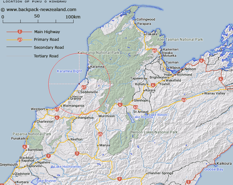
Puku-o-Kongahu Map New Zealand


New Zealand places in our database
[ A ] [ B ] [ C ] [ D ] [ E ] [ F ] [ G ] [ H ] [ I ] [ J ] [ K ] [ L ] [ M ] [ N ] [ O ] [ P ] [ Q ] [ R ] [ S ] [ T ] [ U ] [ V ] [ W ] [ X ] [ Y ] [ Z ]


Closest 20 Points to Puku-o-Kongahu

Puku-o-Kongahu ( 0km )   Kongahu Point ( 0km )   Gentle Annie Point ( 7.55km )   Little Wanganui Head ( 8.24km )   Crayfish Point ( 43.9km )   Mid Point ( 45.9km )   Lovells Point ( 46.39km )   Dee Point ( 49.44km )   Windy Point ( 51.15km )   Kawau Point ( 52.74km )   Cape Foulwind ( 54.46km )   Whakapo?i Point ( 56.72km )   K?taipapa Point ( 58.34km )   Wekakura Point ( 59.55km )   Steep Point ( 63.27km )   Rocks Point ( 67.17km )   Tauparikaka Point ( 71.07km )   Otukoroiti Point ( 72.29km )   Needle Point ( 73.79km )   Kahurangi Point ( 76.95km )   Kaipakati Point ( 83.59km )   Maungahura Point ( 84.55km )   Motukutuka Point ( 85.66km )   Perpendicular Point ( 88.86km )   Brandy Point ( 90.49km )   Dolomite Point ( 92.31km )   Razorback Point ( 93.15km )   Matahua ( 93.58km )   Grossi Point ( 95.18km )   Anawera Point ( 96.85km )   Anarewa Point ( 96.85km )   Rangihaeata Head ( 98.61km )   Tokongawha Point ( 98.8km )   Tukurua Point ( 99.43km )   Guilbert Point ( 101.37km )   Sharks Head ( 102.18km )   Martin Point ( 102.97km )   Sandy Point ( 103.15km )   Yellow Point ( 103.17km )   Melbourne Point ( 104.41km )