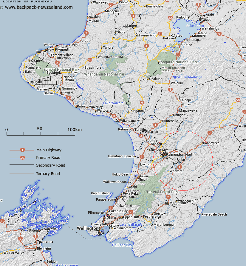
Map showing location of Pukenikau


LINZ description: Appr. 3km north from Pahiatua and 22km east from Palmerston North
Latitude: -40.425557
Longitude: 175.852661
Northing: 5521100
Easting: 1842000
Land District: Wellington
Feat Type: Trig Station


Scroll down to see a more detailed road map and below that a topographical map showing the location of Pukenikau. The road map has been supplied by openstreetmap and the topographical map of Pukenikau has been supplied by Land Information New Zealand (LINZ).

Yes you can use the top static map for you school/university project or personal website with a link back. Contact me for any commercial use.

Pukenikau Map New Zealand


New Zealand places in our database
[ A ] [ B ] [ C ] [ D ] [ E ] [ F ] [ G ] [ H ] [ I ] [ J ] [ K ] [ L ] [ M ] [ N ] [ O ] [ P ] [ Q ] [ R ] [ S ] [ T ] [ U ] [ V ] [ W ] [ X ] [ Y ] [ Z ]


Closest 20 Trig Stations to Pukenikau

Wharite ( 18.95km )   Ross ( 24.03km )   Wahataura ( 27.4km )   Wahatuara ( 27.4km )   Matanginui ( 28.53km )   Matanganui ( 28.53km )   Taramia ( 34.54km )   Taramea ( 34.54km )   Ngapuketurua ( 39.74km )   Ngapuketarua ( 39.74km )   Pakowai ( 41.23km )   Pakowhai ( 41.23km )   Kupukore ( 41.38km )   Kopukore ( 41.38km )   Ruapae ( 41.64km )   Ruapai ( 41.64km )   Pukemoremore ( 45.42km )   Otuarehua ( 46.12km )   Mount Dundas ( 47.75km )   Parawanui ( 50.12km )   Parewanui ( 50.12km )   Oruarongo ( 50.82km )   Wakapapa ( 50.86km )   Whakapapa ( 50.86km )   Koromakau ( 59.34km )   Koromikau ( 59.34km )   Mangatarere ( 65.07km )   Ohuinga ( 66.89km )   Paemutu ( 68.88km )   Mangaweka ( 70.42km )   Kawhatau ( 70.42km )   Wairakai ( 72.2km )   Te Atuaoparapara ( 74.12km )   Dennan ( 74.51km )   Pukekowhai ( 75.88km )   Pukekowai ( 75.88km )   Pariwhariki ( 76.41km )   Pariwhaririki ( 76.41km )   Waimanga North ( 79.74km )   Waimangu North ( 79.74km )