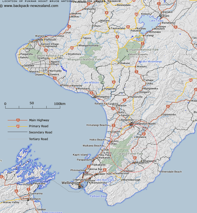
Map showing location of Pukaha / Mount Bruce National Wildlife Centre Reserve


LINZ description: A Government purpose reserve covering 57.3192 hectares, more or less, being Section 1, SO 32447 and Section 1 SO 37485. NZTopo50-BN34 229884.
Latitude: -40.725
Longitude: 175.639167
Northing: 5488419.4
Easting: 1822889.8
Land District: Wellington
Feat Type: Government Purpose Reserve


Scroll down to see a more detailed road map and below that a topographical map showing the location of Pukaha / Mount Bruce National Wildlife Centre Reserve. The road map has been supplied by openstreetmap and the topographical map of Pukaha / Mount Bruce National Wildlife Centre Reserve has been supplied by Land Information New Zealand (LINZ).

Yes you can use the top static map for you school/university project or personal website with a link back. Contact me for any commercial use.

Pukaha / Mount Bruce National Wildlife Centre Reserve Map New Zealand


New Zealand places in our database
[ A ] [ B ] [ C ] [ D ] [ E ] [ F ] [ G ] [ H ] [ I ] [ J ] [ K ] [ L ] [ M ] [ N ] [ O ] [ P ] [ Q ] [ R ] [ S ] [ T ] [ U ] [ V ] [ W ] [ X ] [ Y ] [ Z ]


Closest 20 Government Purpose Reserves to Pukaha / Mount Bruce National Wildlife Centre Reserve

Makerua Swamp Wildlife Management Reserve ( 29.42km )   Turners Lagoon Wildlife Reserve ( 55.78km )   Turner Wildlife Reserve ( 56.88km )   MacKays Crossing Wildlife Reserve ( 62.05km )   Matthews & Boggy Pond Wildlife Reserve ( 67km )   Ruamahanga Cutoff Wildlife Reserve ( 71.77km )   Allsops Bay Wildlife Reserve ( 73.69km )   Pauatahanui Wildlife Reserve ( 73.91km )   Horokiri Wildlife Management Reserve ( 74km )   Lake Kohata Wildlife Management Reserve ( 96.13km )   Government House Reserve ( 96.7km )   Lake Kohangatera Wildlife Reserve ( 96.99km )   Hautapu River Soil Conservation Reserve ( 118.37km )   Pitangi Reserve ( 118.92km )   Tory Channel Leading Lights Reserve ( 124.03km )   Ihupuku Swamp Wildlife Management Reserve ( 134.89km )   Waitaria Bay School Reserve ( 142.37km )   Wairau Lagoons Wetland Management Reserve ( 158.56km )   Para Swamp Wildlife Reserve ( 160.09km )   Tutaekuri Climatic Reserve ( 164.82km )   Mahoe Growth and Preservation of Timber Reserve ( 185.31km )   Oruatua Reserve ( 202.64km )   Neiman Creek Wildlife Reserve ( 218.8km )   Mangahinau Esplanade Reserve ( 225.47km )   Ngamotu Lagoon Wildlife Management Reserve ( 240.64km )   Mapara Wildlife Management Reserve ( 243.79km )   Lake Rotorua Wildlife Reserve - Government Purpose ( 253.38km )   Meyer Block Wildlife Refuge Reserve ( 258.1km )   Westhaven (Whanganui Inlet) Wildlife Management Reserve ( 258.19km )   Cowan Wildlife Refuge ( 260.93km )   Otumatu Rocks Wildlife Reserve - Government Purpose ( 262.71km )   Lake Orotu Wildlife Management Reserve ( 269.03km )   Lake Ngapouri Wildlife Management Reserve ( 272.39km )   Lake Tutaeinanga Wildlife Management Reserve ( 272.42km )   Fort Galatea Wildlife Management Reserve ( 275.65km )   Waikite Wildlife Management Reserve ( 275.98km )   Kapenga Wildlife Management Reserve ( 281.47km )   Sulphur Point Wildlife Sanctuary Reserve ( 292.68km )   Matariki Wildlife Management Reserve ( 299.42km )   Matawhero Wildlife Reserve Depot ( 301.91km )