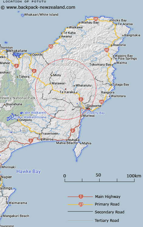
Map showing location of Potutu
LINZ description: Located at north-east side of Waikohu River. Between Maharahara and Kowhainui.
Latitude: -38.425132
Longitude: 177.731373
Northing: 5736400
Easting: 2013100
Land District: Gisborne
Feat Type: Locality
Latitude: -38.425132
Longitude: 177.731373
Northing: 5736400
Easting: 2013100
Land District: Gisborne
Feat Type: Locality

Scroll down to see a more detailed road map and below that a topographical map showing the location of Potutu. The road map has been supplied by openstreetmap and the topographical map of Potutu has been supplied by Land Information New Zealand (LINZ).
Yes you can use the top static map for you school/university project or personal website with a link back. Contact me for any commercial use.
[ A ] [ B ] [ C ] [ D ] [ E ] [ F ] [ G ] [ H ] [ I ] [ J ] [ K ] [ L ] [ M ] [ N ] [ O ] [ P ] [ Q ] [ R ] [ S ] [ T ] [ U ] [ V ] [ W ] [ X ] [ Y ] [ Z ]